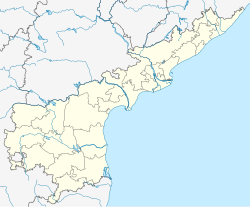
Ambajipeta mandal
Appearance
Ambajipeta | |
|---|---|
| Coordinates: 16°35′38.1″N 81°56′43.1″E / 16.593917°N 81.945306°E | |
| Country | |
| State | Andhra Pradesh |
| District | Dr. B.R. Ambedkar Konaseema |
| Government | |
| • Type | Panchayat |
| • Body | Sarpanch |
| Area | |
• Total | 53.90 km2 (20.81 sq mi) |
| Population (2011)[1] | |
• Total | 63,134 |
| • Density | 1,200/km2 (3,000/sq mi) |
| Languages | |
| • Official | Telugu |
| Time zone | UTC+5:30 (IST) |
| PIN | 533214 |
| Telephone code | 08856 |
| Vehicle Registration | AP05 (Former) AP39 (from 30 January 2019)[2] |
Ambajipeta mandal is one of the 22 mandals in Dr. B.R. Ambedkar Konaseema district of the Indian state of Andhra Pradesh.
Villages
[edit]Ambajipet mandal consists of 14 villages.[3][1] The following are the list of villages in the mandal:
- Chiratapudi
- Gangalakurru
- Gangalakurru Agaragaram
- Irusumanda
- Isukapudi
- K.Pedapudi
- Machavaram
- Mosalipalle
- Mukkamala
- Nandampudi
- Pasuppalle
- Pullettikurru
- Thondavaram
- Vakkalanka
References
[edit]- ^ a b c "District Census Handbook - Konaseema" (PDF). Census of India. pp. 16, 414. Retrieved 3 April 2017.
- ^ "New 'AP 39' code to register vehicles in Andhra Pradesh launched". The New Indian Express. Vijayawada. 31 January 2019. Archived from the original on 28 July 2019. Retrieved 9 June 2019.
- ^ "Mandal-wise village catalog". eastgodavari.nic.in. Archived from the original on 28 March 2017. Retrieved 2 April 2017.


