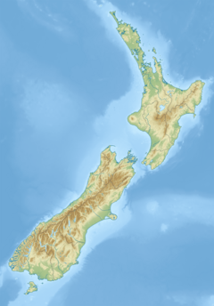
1843 Wanganui earthquake
| UTC time | 1843-07-09 |
|---|---|
| Local date | 8 July 1843 |
| Magnitude | Mw7+ |
| Epicentre | near Whanganui, North Island 40°00′S 176°03′E / 40.000°S 176.050°E |
| Max. intensity | MMI X (Extreme) |
| Casualties | 2 deaths |
The 1843 Whanganui earthquake occurred on 8 July at 16:45 local time with an estimated magnitude of 7.5 on the Mw scale.[1][2] The maximum perceived intensity was IX (Violent) on the Mercalli intensity scale, and possibly reaching X (Extreme).[1] The epicentre is estimated to have been within a zone extending 50 km northeast from Whanganui towards Taihape. GNS Science has this earthquake catalogued and places the epicentre 35 km east of Taihape,[3] near the border of Hawke's Bay. This was the first earthquake in New Zealand over magnitude 7 for which written records exist,[4] and the first for which deaths were recorded.[5]
Tectonic setting
[edit]New Zealand lies along the boundary between the Australian and Pacific plates. In South Island most of the relative displacement between these plates is taken up along a single dextral (right lateral) strike-slip fault with a major reverse component, the Alpine Fault. In North Island the displacement is mainly taken up along the Kermadec subduction zone, although the remaining dextral strike-slip component of the relative plate motion is accommodated by the North Island Fault System (NIFS).[6] A group of dextral strike-slip structures, known as the Marlborough fault system, transfer displacement between the mainly transform and convergent type plate boundaries in a complex zone at the northern end of South Island.[7] The presumed epicentre of the 1843 earthquake is not, however, associated with any known fault.
Earthquake characteristics
[edit]The shock was felt over much of North Island and was reported as lasting for three minutes near Mokoia. A magnitude of 7.5 was estimated from the extent of the area that was subject to a shaking level of at least VIII (Severe). At least ten aftershocks were reported on the same day as the mainshock and further shocks were reported until January 1845.[1]
Damage
[edit]Damage in the Whanganui area reached IX–X on the Mercalli intensity scale.[1] Many houses were damaged, and a brick church at Putiki was destroyed.[5] There was extensive lateral spreading of the terrace margin to the Whanganui River, and a section of Shakespeare Cliff fell into the river. Two people were killed when their house was swept away by one of the landslides caused by the earthquake.[8]
See also
[edit]References
[edit]- ^ a b c d Eiby, George (1968). "A descriptive catalogue of New Zealand earthquakes". New Zealand Journal of Geology and Geophysics. 11 (1): 30–32. Bibcode:1968NZJGG..11...16E. doi:10.1080/00288306.1968.10423671.
- ^ "Significant earthquake". National Geophysical Data Center. Retrieved 28 August 2014.
- ^ "GeoNet – Quakes". Archived from the original on 8 December 2015. Retrieved 12 January 2015.
- ^ "Civil Defence Emergency Management Group Southland. Page on earthquake hazards". Archived from the original on 3 September 2014. Retrieved 28 August 2014.
- ^ a b McSaveney, Eileen. "Landslide related fatalities" (PDF). Te Ara The Encyclopedia of New Zealand. Retrieved 28 August 2014.
- ^ Mouslopoulou, Vasiliki; Nicol, Andy; Little, Timothy & Walsh, John (2007). "Terminations of large strike-slip faults: an alternative model from New Zealand". In Cunningham, W. D. & Mann, P. (eds.). Tectonics of Strike-Slip Restraining and Releasing Bends. Special Publication. Vol. 290. London: Geological Society. pp. 387–415. doi:10.1144/SP290.15.
- ^ Van Dissen, Russ; Yeats, Robert (1991). "Hope fault, Jordan thrust, and uplift of the Seaward Kaikoura Range, New Zealand". Geology. 19 (4): 393–396. Bibcode:1991Geo....19..393V. doi:10.1130/0091-7613(1991)019<0393:HFJTAU>2.3.CO;2.
- ^ A tremulous motion, Barry Hawkins

