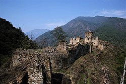
Zhongar Dzong
Appearance
Zhongar Dzong | |
|---|---|
 | |
 | |
| Country | |
| District | Mongar District |
| Structure | Dzong |
Zhongar Dzong is a large medieval ruin overlooking the valley between Lingmethang Town and Thidangbi Village in the Mongar District of Eastern Bhutan. Constructed in the 17th century from white stone mined from the nearby Kuri Chhu river, it once stretched over 4 acres of land and was one of the largest fortresses in the country. Because of its size and construction material, the dzong came to be known as Zhongkar "white bowl" (zhong-bowl, kar-white).[1]
In the late 18th century, the dzong was damaged by a disastrous fire, and then further destroyed by a large earthquake.[2]
References
[edit]- ^ "Ruins of Zhonggar Dzong". DZONGKHAG ADMINISTRATION, MONGAR. Royal Government Of Bhutan.
- ^ "Monggar DT to propose for restoration of Zhongar Dzong to Culture Dept". Bhutan Broadcasting Service. Bhutan Broadcasting Service.
27°17′37″N 91°08′01″E / 27.2936°N 91.1337°E
