Xiatun
Appearance
Xiatun
下屯村 | |
|---|---|
Village | |
| Coordinates: 35°46′07″N 118°46′23″E / 35.7687°N 118.7731°E | |
| Country | People's Republic of China |
| Province | Shandong |
| Prefecture-level city | Rizhao |
| County | Ju |
| Town | Guozhuang |
| Settled | 1666 A.D. |
| Time zone | UTC+8 (China Standard Time) |
| Area Code | 0633 |
| Postal Code | 276533 |
| Xiatun | |||||||
|---|---|---|---|---|---|---|---|
| Chinese | 下屯 | ||||||
| Literal meaning | Village Down from Ridge | ||||||
| |||||||
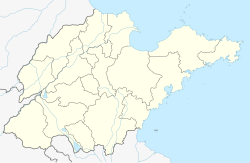
Xiatun (下屯) is a village located in Guozhuang Town (果庄镇), Ju County, Rizhao City, Shandong Province, China.[1][2] The dialect of Xiatun is Qingdao dialect.
Shuidong is on the east, with Guozhuang on the west. On the south is Wangjialing, and north is Tianguangzhuang.
History
[edit]In 1666 AD, Bing settled the village named Xiatun to hide away.[3] To avoid the strong wind, they moved down from the Ridge, renamed the village as Xiazhuang (下庄, literally "the village under the ridge"). To avoid duplicating names, they renamed again, which is Xiatun (下屯) until now.
References
[edit]- ^ 2016年统计用区划代码和城乡划分代码:果庄镇 [2016 Statistical Area Numbers and Rural-Urban Area Numbers: Guozhuang Town] (in Simplified Chinese). National Bureau of Statistics of the People's Republic of China. 2016. Retrieved 13 July 2018.
371122120213 220 下屯村村委会
- ^ 果庄乡 [Guozhuang Township] (in Simplified Chinese). XZQH.org. 20 June 2012. Retrieved 13 July 2018.
【2011年代码及城乡分类】371122204:{...}~213 210下屯村{...
} - ^ Xiatun's history Archived March 4, 2016, at the Wayback Machine

