Xiacheng District
Appearance
Xiacheng
下城区 | |
|---|---|
 Downtown Hangzhou in Xiacheng | |
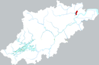
 Location of Xiacheng District within Hangzhou | |
| Coordinates: 30°16′56″N 120°10′52″E / 30.28222°N 120.18111°E | |
| Country | People's Republic of China |
| Province | Zhejiang |
| Sub-provincial city | Hangzhou |
| Area | |
• Total | 29.33 km2 (11.32 sq mi) |
| Population | |
• Total | 403,700 |
| • Density | 14,000/km2 (36,000/sq mi) |
| Time zone | UTC+8 (China Standard) |
| Website | www |
| Xiacheng District | |||||||
|---|---|---|---|---|---|---|---|
| Simplified Chinese | 下城区 | ||||||
| Traditional Chinese | 下城區 | ||||||
| |||||||
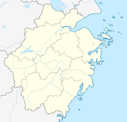
Xiacheng District was one of the former urban districts of the prefecture-level city of Hangzhou, the capital of Zhejiang Province, East China, it is located in the core urban area of Hangzhou.
It has an area of 31 km2 (12 sq mi), and a population of 330,000.[when?] Its postal code is 310006.
The district government is located on 200 Qingchun Rd.
On April 9, 2021, the Xiacheng District was merged to Gongshu District.[1]
Administrative divisions
[edit]Subdistricts:[2]
- Wulin Subdistrict (武林街道), Tianshui Subdistrict (天水街道), Chaohui Subdistrict (朝晖街道), Chaoming Subdistrict (潮鸣街道), Changqing Subdistrict (长庆街道), Shiqiao Subdistrict (石桥街道), Dongxin Subdistrict (东新街道), Wenhui Subdistrict (文晖街道)
References
[edit]- ^ "重磅消息!国务院批复同意杭州部分行政区划优化调整". 杭州网. 2021-04-09.
- ^ "杭州市-行政区划网 www.xzqh.org" (in Chinese). XZQH. Retrieved 2012-05-24.

