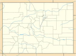
Willard, Colorado
Appearance
Willard, Colorado | |
|---|---|
Location in Logan County and the state of Colorado | |
| Coordinates: 40°33′16″N 103°29′08″W / 40.55444°N 103.48556°W | |
| Country | |
| State | |
| County | Logan County[1] |
| Elevation | 4,337 ft (1,322 m) |
| Time zone | UTC-7 (MST) |
| • Summer (DST) | UTC-6 (MDT) |
| ZIP code[2] | 80741 (Merino) |
| Area code | 970 |
| GNIS feature ID | 0182787 |
Willard is an unincorporated community located in Logan County, Colorado, United States.
History
[edit]The Willard, Colorado, post office operated from September 26, 1888, until April 19, 1894.[3] Willard was named for Willard House, who owned land in the area.[4] The post office reopened as Arnold, Colorado, on January 26, 1897, but the name was changed back to Willard on March 30, 1900.[3] The Willard post office closed on February 28, 1901, but reopened on April 5, 1910, and operated until July 14, 1967.[3] The U.S. Post Office at Merino (ZIP Code 80741) now serves Willard postal addresses.[2]
Geography
[edit]Willard is located at 40°33′16″N 103°29′08″W / 40.55444°N 103.48556°W (40.554374,-103.485546).
See also
[edit]- Bibliography of Colorado
- Geography of Colorado
- History of Colorado
- Index of Colorado-related articles
- List of Colorado-related lists
- Outline of Colorado
References
[edit]- ^ a b "US Board on Geographic Names". United States Geological Survey. October 25, 2007. Retrieved January 31, 2008.
- ^ a b "ZIP Code Lookup" (JavaScript/HTML). United States Postal Service. January 3, 2007. Retrieved January 3, 2007.
- ^ a b c Bauer, William H.; Ozment, James L.; Willard, John H. (1990). Colorado Post Offices 1859–1989. Golden, Colorado: Colorado Railroad Historical Foundation. ISBN 0-918654-42-4.
- ^ Exploring Colorado Highways: Trip Trivia. Exploring America's Highway. 2007. p. 109. ISBN 978-0-9777301-0-0.


