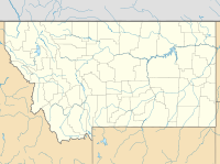
West Lolo Complex Fire
Appearance
This article relies largely or entirely on a single source. (August 2021) |
| West Lolo Complex | |
|---|---|
| Date(s) | July 8, 2021 – present |
| Location | Plains, Montana |
| Coordinates | 47°24′36″N 114°59′17″W / 47.41°N 114.988°W |
| Statistics | |
| Burned area | 39,053 acres (15,804 ha) |
| Ignition | |
| Cause | Lightning |
| Map | |
The West Lolo Complex is a large wildfire complex currently burning near Plains, Montana. The fires started on July 8 by lightning. Started by lightning strikes, the fires have collectively burned 39,053 acres (15,804 ha) and is 15% percent contained as of August 5, 2021.[1]
Events
[edit]July
[edit]The West Lolo Complex was first reported on July 8, 2021 at around 11:10 am MST.[1]
August
[edit]This section is empty. You can help by adding to it. (August 2021) |
Containment
[edit]As of August 20, 2021 the fire is 15% contained.[1]
Current closures
[edit]Closures
[edit]This section is empty. You can help by adding to it. (August 2021) |
Impact
[edit]Evacuations
[edit]This section is empty. You can help by adding to it. (August 2021) |
References
[edit]- ^ a b c "West Lolo Complex Information - InciWeb the Incident Information System". inciweb.nwcg.gov. Retrieved 2021-08-05.

