Waggarandall
Appearance
| Waggarandall Victoria | |||||||||||||||
|---|---|---|---|---|---|---|---|---|---|---|---|---|---|---|---|
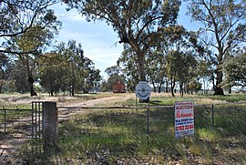
 Uniting church | |||||||||||||||
| Coordinates | 36°15′07″S 145°48′02″E / 36.25194°S 145.80056°E | ||||||||||||||
| Population | 40 [1] (2016 census) | ||||||||||||||
| Postcode(s) | 3646 | ||||||||||||||
| LGA(s) | Shire of Moira | ||||||||||||||
| State electorate(s) | Ovens Valley | ||||||||||||||
| Federal division(s) | Nicholls | ||||||||||||||
| |||||||||||||||
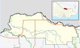
Waggarandall is a locality in the Shire of Moira, Victoria.
Waggarandall post office opened on 12 February 1879 and was closed on 31 December 1964.[2]
References
[edit]- ^ "2016 Waggarandall, Census All persons QuickStats | Australian Bureau of Statistics". abs.gov.au. Retrieved 25 May 2022.
- ^ Premier Postal History, Post Office List, retrieved 12 December 2011
External links
[edit]![]() Media related to Waggarandall at Wikimedia Commons
Media related to Waggarandall at Wikimedia Commons

