Valtorta, Lombardy
Appearance
Valtorta | |
|---|---|
| Comune di Valtorta | |
 Valtorta | |
| Coordinates: 45°59′N 9°32′E / 45.983°N 9.533°E | |
| Country | Italy |
| Region | Lombardy |
| Province | Bergamo (BG) |
| Government | |
| • Mayor | Pietro Busi |
| Area | |
• Total | 30.9 km2 (11.9 sq mi) |
| Elevation | 935 m (3,068 ft) |
| Population (30 April 2017)[2] | |
• Total | 271 |
| • Density | 8.8/km2 (23/sq mi) |
| Demonym | Valtortesi |
| Time zone | UTC+1 (CET) |
| • Summer (DST) | UTC+2 (CEST) |
| Postal code | 24010 |
| Dialing code | 0345 |
| Patron saint | Assumption of Mary |
| Saint day | 15 August |
| Website | Official website |


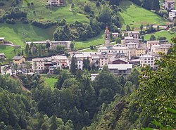
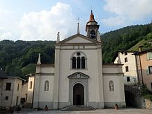
Valtorta (Bergamasque: Altòrta) is a comune (municipality) in the Province of Bergamo in the Italian region of Lombardy, located about 60 kilometres (37 mi) northeast of Milan and about 35 kilometres (22 mi) northwest of Bergamo.
Valtorta borders the following municipalities: Barzio, Cassiglio, Gerola Alta, Introbio, Ornica, Vedeseta.
Ski
[edit]Valtorta houses the starting point of a cable way that reaches the ski area of Piani di Bobbio. At Ceresole there was also a cross country ski track.
References
[edit]- ^ "Superficie di Comuni Province e Regioni italiane al 9 ottobre 2011". Italian National Institute of Statistics. Retrieved 16 March 2019.
- ^ All demographics and other statistics: Italian statistical institute Istat.


