User talk:Hajji Piruz/geographysource
Appearance
Sections
[edit]Pre-Islamic
[edit]Post-Islamic
[edit]1220-1221 Ibn al-Athir on the Tartar (Mongol) invasions:
| “ | ...whence they marched on the towns of Adharbayjan and Arraniyya, destroying them and slaying most of their inhabitants, of whom none escaped save a small remnant; and all this in less than a year; this is a thing whereof the like has not been heard. And when they had finished with Adharbayjan and Arraniyya, they passed on to Darband-i-Shirwan, and occupied its cities, none of which escaped save the fortress wherein was their King;[1] | ” |
1339-40 - Ḥamd-Allāh ibn Abī Bakr Qazvīnī Mustawfi, in his Nuzhat al-qulub:
| “ | Thus the provinces of the two Iraqs, Adharbayjan, Arran and Mughan, Shirvan, Ghushtasfi and in part of Gurjistan, and in the whole of Kurdistan, Qumis, Mazandaran, Tabaristan, Jilanat and in part also of Khurasan, it is necessary when you would stand facing the Qiblah that the north pole should be behind...[2] | ” |
1757-8 - Mīrzā Muḥammad Mahdī Ḫān “Kawkabī” Astarābād:
| “ | The most remarkable cities of Azerbaijan are; 1. Ardebil, considered Sacred by the Persians, for containing the tombs of Sefiaddin and Heider, the vernerable ancestors of the Sefi family. 2. Tabriz, commonly called Tauris, which, in the last century, was a large and beautiful city...The great cities of Arran and Armenia are Gangia, and Erivan...The cities of Shirvan are, 1. Bacu, a port on the Caspian lake, whence it is called the Sea of Bacu: 2. Shamakhi, a city well known to the Russians: and 3. Derbend...which stands at the foot of Mount Caucasus or Keitaf, and commands the Caspian...[3] | ” |
Modern (19th and early 20th centuries)
[edit]1824 - The History of Herodotus:
| “ | The city of Ecbatana was unquestionable on or near the site of Hamadan, in Al Jebal. A great number of authorities concur in proving this, although many refer to it as Tauris, or Tebriz, in Aderbigian.[4] | ” |
1888 - A Classical Dictionary:
| “ | Atropatia or Atropatene, a name given to the North Western part of Media, between Mount Tauris and the Caspian Sea. It recieved its name from Atropates...it is now called Aderbigian from the Persian term Ader, signifying fire; according to teh tradition that Zerdust or Zoroaster lighted a pyre, or temple of fire, in a city named Urmia, of his native country. Its metropolis was Gaza, now Tebriz, or as it is more commonly pronounced,Tauris.[5] | ” |
1890 - Russian Brockhaus and Efron Encyclopedic Dictionary, states the following in the article called "Azerbeijan":
| “ | Azerbeijan, or Aderbeijan — fire land; 'Atrupatkan' in Pahlavi and 'Aderbadekan' in Armenian, is the north-westernmost province and the richest trade and industrial region of Persia. It borders Persian Kurdistan and Iraq of Adjam (Media) to the south, Turkish Kurdistan and Armenia to the west, Russian Armenia (Southern Transcaucasia), from which it is separated by the Aras River, to the north, Russian province of Tashil to the east and Persian province of Gilan near the Caspian sea.[6] | ” |
1901 - Journal of the Royal Asiatic Society of Great Britain and Ireland:
| “ | Description of Marvels in various pats of Iran: -In Khurasan, Kumis, Mazandaran, and Kuhistan, 243n' in 'Irak 'Ajam, Kurdistan, Luristan, and Gilan, 243s; in Fars, Kirman, and Shabankarah, 246e; in Adharbayjan, Mughan, Arran, and Shirvan, 247;[7] | ” |
| “ | Mughan or Mukan is still the name of the Steppe country lying south of the lower course of the Aras river.[7] | ” |
| “ | The territory of Arran, which the Arab geographers always spell Al-Ran (pronounced Ar-Ran), as though it were an Arabic name, is the triangle of land included between the rivers Aras and Kur - the Arazes and Cyrus.[7] | ” |
| “ | The province of Shirvan lay to the north of the Kur river, and extended to teh foot of that part of the Caucasus range known to Moslem geographers as Darban-i-Bab-al-Abwab - 'the Barrier of the Gate of Gates.' Bakuyah, or Baku, was its port on the Caspian, and Shamakhi inland - now called Shemakha - was the capital city... [7] | ” |
1911 - Encyclopaedia Britannica, states the following in the article called "Azerbaijan":
| “ | AZERBAIJAN (also spelt ADERBIJAN; the Azerbadegan of medieval writers, the Athropatakan and Atropatene of the ancients), the north-western and most important province of Persia. It is separated from Russian territory on the N. by the river Aras (Araxes), while it has the Caspian Sea, Gilan and Khamseh (Zenjan) on the E., Kurdistan on the S., and Asiatic Turkey on the W.[8] | ” |
Maps
[edit]-
Reconstruction of Herodotus' world map, depicting Media below the Araxes (Aras) river (450 BC)
-
A classic map of Eurasia which includes the regions of Media and Caucasian Albania (1711)
-
Map showing the seperate regions of Armenia, Albania, and Azerbaijan (1719)
-
Map of Persia including Azerbaijan, which is bounded by the Aras river to its North (1835)[9]
-
Map of Persia including Azerbaijan (1856)[10]
-
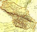
Map showing the administrative divisions of Russia's Caucasian holdings, which are labeled Baku, Erivan, Elizabetpol, Georgia, and Derbent, among others (1882)
-
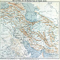
Map showing the Russian and British spheres of influence in Persia. Region under the Aras (Araxes) is labeled as Azerbaijan (1905)
-
The region of Azerbaijan depicted with the Aras river as its northern boundary (1909)
References
[edit]- ^ On the Tartars by Ibn al-Athir, from Edward G. Browne, A Literary History of Persia, (Cambridge: Cambridge University Press, 1902), Vol. II, pp. 427-431.
- ^ Nuzhat al-qulūb by Ḥamd-Allāh ibn Abī Bakr Qazvīnī Mustawfi 1339-40, republished in 1919 as The Geographical Part of the Nuzhat-al-qulūb page 24
- ^ The History of the Life of Nader Shah Part I Chapter I
- ^ The History of Herodotus published in 1824, Vol. 1 page 54
- ^ A Classical Dictionary by Charles Anthon, L.L.D. Published 1888 page 231
- ^ (in Russian) Brockhaus and Efron Encyclopedic Dictionary. "Azerbeijan". St. Petersburg, Russia, 1890-1907
- ^ a b c d Journal of the Royal Asiatic Society of Great Britain and Ireland published in 1902, Chap 3 page 63, Chap 4 page 255-254, Chap 5 page 256
- ^ Encyclopaedia Britannica 1911
- ^ [1] 1837 Malte-Brun Map of Persia & Arabia (Iraq, Saudi Arabia, Iran, Jordan )
- ^ Map showing the region north of Iran's Caucasus border as Georgia


![Map of Persia including Azerbaijan, which is bounded by the Aras river to its North (1835)[9]](http://up.wiki.x.io/wikipedia/commons/thumb/c/c4/Near_East-1835.jpg/120px-Near_East-1835.jpg)
![Map of Persia including Azerbaijan (1856)[10]](http://up.wiki.x.io/wikipedia/commons/thumb/9/9c/Afghanistan_and_Persia_in_1856.jpg/120px-Afghanistan_and_Persia_in_1856.jpg)

