User:Djflem/Portway (New Jersey)
| This is not a Wikipedia article: It is an individual user's work-in-progress page, and may be incomplete and/or unreliable. For guidance on developing this draft, see Wikipedia:So you made a userspace draft. Find sources: Google (books · news · scholar · free images · WP refs) · FENS · JSTOR · TWL |
Portway extends 25km (16mi) north-south from the Trumbull St Yard of CSX in southern Elizabeth at the Turnpike’s IC-13 to Little Ferry Yard near IC-18 of the Turnpike, and involves east west links of significance also.
Rail
[edit]http://www.state.nj.us/transportation/freight/portway/FR_Appendix_B.pdf
PROJECTS UNDER CONSTRUCTION
Projects from Port Newark north to North Bergen Yard • Doremus Avenue reconstruction and bridge replacement, from south of Port Street to north of Wilson Avenue. • Doremus Avenue reconstruction and widening, from north of Wilson Avenue to north of Raymond Boulevard. • Construction of operational improvements to the Tonnelle Circle and elimination of the Charlotte Circle. PROJECTS IN PRELIMINARY OR FINAL DESIGN • The Route 1&9 St. Paul’s Avenue Bridge Replacement. • The Route 7 Wittpenn Movable Span Bridge Replacement across Hackensack River between Kearny and Jersey City. PROJECTS IN FEASIBILITY ASSESSMENT • Enhanced access to NJ Turnpike interchange 15-E. • Reconstruction of the Doremus Avenue Interchange with Route 1&9 Truck. • New crossing of the Passaic River using abandoned railroad alignment and infrastructure, supplementing the existing Route 1&9 Truck crossing. The new crossing is intended to connect Doremus Avenue and Central Avenue. • Central Avenue improvements including enhancement of its interchange with Route 1&9 Truck. • Enhancement of Pennsylvania Avenue and Fish House Road, and improved access to Kearny Intermodal Railyard. • A New Road connecting St. Paul’s Avenue to Croxton Intermodal Railyard and Secaucus Road.
http://www.state.nj.us/transportation/freight/portway/FR_Section_6.pdf
http://www.roadsbridges.com/doremus-avenue-bridge-replacement-newark-nj Doremus Avenue Bridge
http://tollroadsnews.com/news/nj-portway
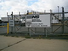
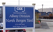
The Portway Project is of planned transportation infrastructure improvements to improve Intermodal freight transport along a corridor between Port Newark-Elizabeth at the south and intermodal terminals in North Bergen in the north, generally running parallel to U.S. Route 1/9 in the northeastern New Jersey and rail lines in Conrail's North Jersey Shared Assets Area.
The extensive project is conceived to facilitate freight transshipment through the Port of New York and New Jersey known as Portway.
Funding for the project comes from the New Jersey Department of Transportation and the Port Authority of New York and New Jersey.[1][2]
First conceived and proposed in the late 1990s.http://tollroadsnews.com/news/jersey-portsnewark-jersey-city-projects http://www.tstc.org/bulletin/19990702/mtr22709.htm http://www.state.nj.us/transportation/freight/portway/FR_Section_1.pdf
It is anticipated that with the opening of the an expanded Panama Canal and the raising of the Bayonne Bridge, warehouse and distribution activity along the corridor will increase.[3][4]
River crossings
[edit]The Lincoln Highway Passaic River Bridge and the are along the route. While there ha been discussion to built new bridges dedicated to Portway along route the plan has not advanced. Proposals have included new bridge along the former Newark and New York Railroad right-of-way adjacent to the DB Draw over the Passaic River [5] A new bridge could include a rail component.
[6][7] Studies are being conducted as part of an extensive project conceived to facilitate freight transshipment through the Port of New York and New Jersey known as Portway. A new bridge could include a rail component. The new structure would allow for a dual bridge crossing in combination with the Lincoln Highway Passaic River Bridge.[8]
The replacement of the Wittpenn Bridge over the Hackensack River.
[9]
and an another higher fixed bridge adjacent to the replacement of the moveable Wittpenn Bridge. over the Hackensack.[10]
Facilities and roadways
[edit]http://www.panynj.gov/about/pdf/cpip/CPIP_Plan/V1_App_C.pdf Yards Port Authority http://www.csx.com/index.cfm/about-csx/company-overview/state-fact-sheets/new-jersey/


- Port Newark-Elizabeth
- Newark Airport Interchange
- Doremus Avenue
- Oak Island Yard
- Lincoln Highway Passaic River Bridge
- South Kearny
- Wittpenn Bridge
- Marion, Jersey City
- Croxton Yard
- North Bergen Yard
- Little Ferry Yard
References
[edit]- ^ "PANY&NJ-NJDOT Project Program" (PDF). FY 2013 TRANSPORTATION CAPITAL PROGRAM. New Jersey Department of Transportation. Retrieved 2014-11-21.
- ^ "Portway". New Jersey Department of Transportation. Retrieved 2014-11-21.
- ^ Kaysen, Ronda (August 21, 2012). "A $650 Million Expansion of Port Newark Spurs Interest in Its Environs". The New York Times. Retrieved 2014-11-21.
- ^ "Insights: Economic Impact of the Panama Canal Expansion in the NJ Industrial Market". Cassidy Turley. November 2012. Retrieved 2014-11-21.
{{cite news}}: Check date values in:|date=(help) - ^ "Lower Passaic River Restoration Project Commercial Navigation Analysis" (PDF). United States Army Corps of Engineers. July 2, 2010 (2nd Revision). Retrieved 2012-08-05.
The abutments of a formerly utilized railroad freight bridge (Central Railroad of NJ) lie at approximately RM 1.2. These abutments limit channel width to 145 feet. However, NJDOT is currently investigating the feasibility of a new Lower Passaic River Bridge within the existing alignment of the former railroad freight bridge. If construction of the new bridge was to move forward, the derelict structure at RM 1.2 would be removed and would be replaced with a structure designed with adequate horizontal and vertical clearance for typical vessel traffic on the Lower Passaic River
{{cite web}}: Check date values in:|date=(help) - ^ "Port Newark/Elizabeth Northern NJ Rail Terminals". Port Connector Projects New Jersey-New York. Waterfront Coalition. Retrieved 2012-08-09.
- ^ Portway Extensions Concept Development Study (PDF) (Report). NJDOT. September 26, 2003.
New crossing of the Passaic River using abandoned railroad alignment and infrastructure, supplementing the existing Route 1&9 Truck crossing. The new crossing is intended to connect Doremus Avenue and Central Avenue.
- ^ "Portway-Passaic River Crossing" (PDF). FY 2010-2011 Studies and Development. NJDOT. Retrieved 2012-08-08.
This project will study Doremus Avenue, Passaic River Crossing and Central Avenue over Route 1&9T as one project because of their connectivity. The areas of the project service industrial and commercial facilities in a section of Newark and the southern section of Kearny. The purpose of the proposed improvement is to create a connection with NJ Turnpike at Interchange 15E and Route 1&9T, and/or another variation of the two. The improved section will serve to improve access to/from trucking distribution facilities along Doremus Avenue and the NJ Turnpike and will help reduce truck traffic on Route 1&9T. It will range from replacing the existing Route 1&9T bridge to providing dual bridge structures. The reconfiguration of Central Avenue/Route 1&9T interchange may provide four 12-foot travel lanes and two 12-foot shoulders to improve flow and safety. The proposed geometry will primarily follow the existing alignment except at the interchange. Sidewalks could be provided within the proposed berm. A rail crossing on the same facility will also be investigated as part of this project.
- ^ http://www.amercomcorp.com/projects/route-7-whitpenn-bridge-replacement/
- ^ Koglin, Terry L. (2003), Movable Bridge Engineering, Wiley, p. 15, ISBN 978-0-471-41960-0

