Tripoli District, Lebanon
Appearance
Tripoli District | |
|---|---|
District | |
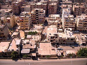
 A neighborhood in east Tripoli | |
| Coordinates: 34°26′N 35°51′E / 34.433°N 35.850°E | |
| Country | |
| Governorate | North Governorate |
| Capital | Tripoli |
| Area | |
• Total | 17 sq mi (45 km2) |
| Population | |
• Estimate (31 December 2017) | 342,760 |
| Time zone | UTC+2 (EET) |
| • Summer (DST) | UTC+3 (EEST) |
The Tripoli District is a small, but very densely populated district in the North Governorate of Lebanon. It consists of the city Tripoli, its port town El Mina and the surrounding area. The vast majority of residents are Sunni Muslim (approximately 80%), a small minority Orthodox and Maronite Christians, and a small minority of Alawite Muslims.
Municipalities
[edit]Demographics
[edit]As of 2022, the religious make-up of the District's 254,438 voters were roughly 83% Sunni, 7% Alawite, 5% Greek Orthodox, 2% Maronite Catholics, 1% Shia, and 2% others.[1]

