Template:Infobox mountain/Berg/doc
| This is a documentation subpage for Template:Infobox mountain/Berg. It may contain usage information, categories and other content that is not part of the original template page. |
This template should always be substituted (i.e., use {{subst:Infobox mountain/Berg}}). Any accidental transclusions will be automatically substituted by a bot. |
Usage
[edit]This template enables data on mountains imported from German Wikipedia (using de:Vorlage:Infobox Berg) to be translated and displayed in English Wikipedia. This saves the enormous amount of work otherwise entailed in translating parameters and data into en.wiki templates. Some of this translation involves technical terms that may not be obvious to some translators. In addition, en.wiki templates are not capable of displaying all the information provided here.
The template is available for the hundreds of articles on German, Austrian and Swiss mountains being translated into English Wikipedia that will be able to take full advantage of its features.
When translating an article from German Wikipedia, just import the infobox and translate any free text. It is worth previewing the result first as data in several parameters will be automatically translated if recognised; otherwise it defaults to the entered text. This feature is being enhanced continually. Blank parameters are ignored. The parameter text is shown below; their use is explained in the Parameters section.
Coordinates
[edit]The display of coordinates has now been automated.
{{Infobox Berg
| NAME =
| BILD =
| BILDBESCHREIBUNG =
| HÖHE =
| HÖHE-BEZUG =
| LAGE =
| GEBIRGE =
| BREITENGRAD =
| LÄNGENGRAD =
| REGION-ISO =
| TYP =
| GESTEIN =
| ALTER =
| ERSTBESTEIGUNG =
| NORMALWEG =
| BESONDERHEITEN =
}}
The following parameters are relevant for isolation and prominence information:
| DOMINANZ =
| SCHARTENHÖHE =
| DOMINANZ-BEZUG =
| SCHARTE =
| SCHARTE-BEZUG =
Parameters
[edit]| Parameter | Meaning | Type | Explanation |
|---|---|---|---|
| NAME | Name | optional | Name in the header of the infobox; default is the article name. |
| NEBENBOX | Additional box | (Value equal) | If this parameter is set the creation of article sections outside the box is suppressed, for example the article coordinates. This is necessary if more than one box is used in an article. All boxes apart from one must then be marked with NEBENBOX. If, in addition, the location map is to be suppressed, because it is the same for several boxes, the code POSKARTE=none must also be set (see below)
|
| BILD | Image | optional | Name of an image with a view of the mountain. Landscape views work better than portrait views and should be preferred. Images that show the whole mountain should be preferred over those with just a shot of the summit. Images that do not show the mountain, but are simply a view from the mountain, or just a map, are better entered under BILD1 to BILD5, because these parameters are used for checking missing images. |
| BILD-BREITE | Image width | optional | Used for entering the width of the image at BILD; inevitably this has an impact on the image height as well. The default is 324x300px. This defines the largest surrounding rectangle, images will not be cropped.
|
| BILDBESCHREIBUNG | Caption | optional | The caption underneath the image. It should be clear from the text, which (of several) mountains in an image is the subject of the article. Entering the following information in the text is useful: direction of shot ("from the north", The north face of the XXX, …), location (seen from YYY) and time of year if relevant. At the least this information should be available in detail at the image page itself. |
| HÖHE | Height | optional | Height as a number without thousand separator, e.g. 4321. It will be automatically formatted by the template e.g. 4,321. Entries with decimal places must use a decimal point not a comma, e.g. 1234.5 in order to be displayed correctly 1,234.5.
Based on the height the category from Category:One-thousanders … Category:Eight-thousanders will be entered, i. e. the category does not have to be entered manually. |
| HÖHE-BEZUG | Height datum | optional | Entry of the mountain's height datum, on which the height is based
If the height datum is not known, do not enter anything in this parameter! This will automatically generate "m" (for metres). Entering "m" or "metres" is counter-productive and should not be done. |
| HÖHE-ANMERKUNG | Height remarks | optional | Any remarks about the height which are entered on the same line in the infobox. These could be other measurements that are important enough for the infobox or, for mountains on country borders, the different heights in different reference systems (HÖHE-BEZUG).
Examples: | HÖHE = 3401
| HÖHE-BEZUG = AT
| HÖHE-ANMERKUNG = ({{Höhe|3402|CH}} (Switzerland) or {{Höhe|3399|IT}} (Italy))
expands in the infobox to Height: 3,401 m (AA) (3,402 m above M (Switzerland) or 3,399 m s.l.m. (Italy)) | HÖHE = 3401
| HÖHE-BEZUG = AT
| HÖHE-ANMERKUNG = (according to other sources {{Höhe|3399|AT}})
}}
expands in the infobox to Height: 3,401 m (AA) (according to other sources 3,399 m above A.). |
| LAGE | Location | optional | The location of the mountain, e. g. "Tyrol, Austria" or even "Border of Tyrol, Austria / Italy", the entries should be linked. |
| GEBIRGE | Range | optional | The range in which the mountain lies, e. g. "Bernese Alps". |
| DOMINANZ | Isolation | optional, numerical | The isolation gives the distance (in kilometres) to the next higher mountain. |
| DOMINANZ-BEZUG | Isolation datum | optional | The next higher mountain; can be linked. |
| SCHARTENHÖHE | Prominence | optional, numerical | The prominence is a measurement (in metres) for the 'independence' of a mountain. |
| SCHARTE-BEZUG | Prominence datum | optional | The higher mountain, which can be reached with the least loss of height. This mountain need not be the same as the nearest dominating mountain. It is a dominant mountain, but not necessarily the nearest. Can be linked. |
| SCHARTE | Wind-gap | optional | Name of the wind-gap related to the prominence above. |
| BREITENGRAD und LÄNGENGRAD | Latitude and Longitude | optional | The WGS84 coordinates for the (highest) summit on the mountain. Should be given in decimal format; the template automatically converts this to dms in the display. If not, convert to decimal or enter the dms data under the COORD parameter, as the format is not supported by Template:Coord. |
| COORD | Coordinates | optional | Enter the coordinates using Template:Coord. May be used if data are in dms format. Entry here will suppress any preceding BREITENGRAD und LÄNGENGRAD entries. Location map will not display as it cannot interpret Template:Coord. Better to use decimal data under BREITENGRAD und LÄNGENGRAD, which will automatically display in dms format anyway. |
| REGION-ISO | ISO region | optional | A combination of the relevant ISO 3166-1 or ISO 3166-2 codes. Especially for mountains that often lie on state borders, the value consists of more than one ISO code, these should be separated by "/" (NB: not tested). e. g. AT-7/DE-BY for a mountain on the Tyrolean-Bavarian border.
The default location map will be taken from the first section of a multiple ISO code entry. For that reason the sequence of codes is relevant. |
| KARTE | Map | optional | Name of an image for a map. If this parameter is set, this map will be used instead of the automatically generated location map. |
| POSKARTE | Location map | optional | Name of an alternative location map. This will overwrite the location map derived from REGION-ISO. Setting this to none will suppress the display of a location map. |
| ALTERNATIVKARTE | Alternative map | optional | Alternative map (image) in relation to a POSKARTE or REGION-ISO fixed datum. |
| TOPO-KARTE | Relief map | optional | Link to a relief map. |
| TYP | Type of mountain | optional | The type of mountain. Valid entries include: Volcano (Vulkan), Felsgipfel, Kegelberg, mesa (Tafelberg), ridge (Bergrücken), Ice age moraine (eiszeitliche Moräne), Schuttberg (Trümmerberg) (an artificially amassed hill) etc. |
| GESTEIN | Rock | optional | The rock forming the mountain, e. g. sandstone (Sandstein), basalt, etc. |
| ALTER | Age | optional | The geological age of the rock, e. g. "Turonian". |
| LETZTE ERUPTION | Last eruption | optional | The last volcanic eruption (only for volcanos). |
| ERSTBESTEIGUNG | First climbed | optional | Date and individual(s) who first climbed the summit. People may be linked. |
| ERSCHLIESSUNG | Access | optional | Man-made access to or on the mountain e. g. construction of a cable car, an observation tower, etc. |
| NORMALWEG | Normal route | optional | Entry for the normal route to the top e. g. "South arete" with details of the Alpine level of difficulty. Can be given as e. g. "Hike" |
| BESONDERHEITEN | Remarks | optional | Additional remarks or features e. g. "Highest mountain in the Eifel" |
| BILD1 bis BILD5 | Image1 to Image5 | optional | Optional images added below the infobox |
| BILD1-BREITE bis BILD5-BREITE | Image1 width to Image2 width | optional | The width of the images BILD1 to BILD5 above; defaults to 324x300px. See remarks for main image above.
|
| BILD1-BESCHREIBUNG bis BILD5-BESCHREIBUNG | Caption1 to Caption5 | optional | Captions for the extra images |
Example
[edit]In this example all parameters are completed to give a feel for the functionality of the infobox.
| Testberg | |
|---|---|
 | |
| Highest point | |
| Elevation | 999.9 m (3,281 ft) (would be 1,000.2 DE-HNH ) |
| Prominence | 200 m ↓ Maloja Pass → Großglockner |
| Isolation | 0.1 km → Mont Blanc |
| Coordinates | 45°20′44″N 6°30′21″E / 45.3456°N 6.5059°E |
| Geography | |
 | |
| Location | South of Testland |
| Parent range | Testgebirge |
| Geology | |
| Rock age | Tertiary |
| Mountain type(s) | Dolomite Dormant volcano |
| Rock type | Dolomite |
| Last eruption | 2000 |
| Climbing | |
| First ascent | 17 March 1875 by Hans Müller |
| Easiest route | Cable car |
| Normal route | From mountain hut via the east arete |
| Access | Neudorf Cable Car |
{{Infobox Berg1
| NAME = Testberg
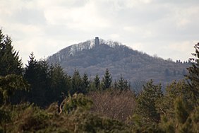
| BILD = HoheachtRassberg.jpg
| BILDBESCHREIBUNG = The Testberg
| HÖHE = 999.9
| HÖHE-ANMERKUNG = <br />(would be {{Höhe|1000.2|DE-HNH}})
| LAGE = South of Testland
| GEBIRGE = Testgebirge
| DOMINANZ = 0.1
| SCHARTENHÖHE = 200
| DOMINANZ-BEZUG = [[Mont Blanc]]
| SCHARTE = [[Maloja Pass]]
| SCHARTE-BEZUG = [[Großglockner]]
| BREITENGRAD = 45.3456<!-- 45{{!}}40{{!}}39 -->
| LÄNGENGRAD = 6.5059
| REGION-ISO = FR
| TYP = Dormant [[volcano]]
| GESTEIN = [[Dolomite (mineral)|Dolomite]]
| ALTER = [[Tertiary]]
| LETZTE ERUPTION = 2000
| ERSTBESTEIGUNG = 17 March 1875 by Hans Müller
| ERSCHLIESSUNG = Neudorf Cable Car
| LEICHTESTE ROUTE = Cable car
| NORMALWEG = From mountain hut via the east arete
| BESONDERHEITEN = Only a fictional mountain!
| BILD1 = weltkarte.jpg
| BILD2 = weltkarte.jpg
| BILD2-BREITE = 250px
| BILD2-BESCHREIBUNG = World map
}}
See also
[edit]- Template:Infobox mountain (used by this template)
- Template:Infobox Gebirgsgruppe (German version of Template:Infobox mountain range)


