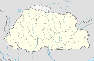
Tala, Bhutan
Appearance
Tala | |
|---|---|
| Coordinates: 26°52′N 89°34′E / 26.867°N 89.567°E | |
| Country | |
| District | Chukha District |
| Time zone | UTC+6 (BTT) |
Tala[1] is a town in Chukha District in southwestern Bhutan, known for the Tala Hydroelectricity Project.[2]
References
[edit]- ^ there seems to be a confusion here, as Tala and Dala and Darla refer to the same place, while the Tala Hydro is not based in Tala town, but its offices were in Gedu and its works at Sinchekha; the offices and staff housing has been recently moved out of Gedu town see eg Leo van der Velden, "Sinchekha PO: a Post Office in a Tin Shed" in 'Postal Himal', #150, 2nd Quarter 2012 http://himalaya.socanth.cam.ac.uk/collections/journals/postalhimal/pdf/PH_2012_002.pdf
- ^ "NGA GeoName Database". National Geospatial-Intelligence Agency. Archived from the original on 2008-06-08. Retrieved 2008-07-03.
External links
[edit]

