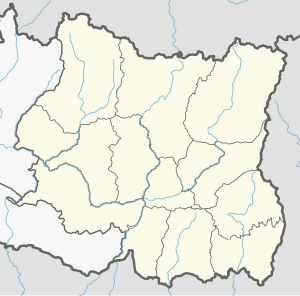
Sunkoshi Rural Municipality, Okhaldhunga
Sunkoshi Rural Municipality
सुनकोशी गाउँपालिका | |
|---|---|
Rural Municipality | |
| Coordinates: 27°17′02″N 86°22′37″E / 27.284°N 86.377°E | |
| Country | Nepal |
| Province | Province No. 1 |
| District | Okhaldhunga District |
| Established | March 2017 |
| Government | |
| • Chairperson | Mr. Kamal Tamang (NC) |
| • Vice Chairperson | Mis Sunita Adhikari (NC) |
| Area | |
| • Total | 143.75 km2 (55.50 sq mi) |
| Population | |
| • Total | 18,550 |
| • Density | 129.04/km2 (334.2/sq mi) |
| • Ethnicities | Tamang Chettri |
| Website | official website |
Sunkoshi Rural Municipality (Nepali: सुनकोशी गाउँपालिका) in Okhaldhunga District was formed in March 2017, by merging 5 former VDCs of Katunje, Chyanam, Mulkharka, Sisneri and Balakhu.[1] The center of this rural municipality is located at Mulkharka.
Demographics
[edit]At the time of the 2011 Nepal census, Sunkoshi Rural Municipality had a population of 18,558. Of these, 58.1% spoke Nepali, 18.9% Tamang, 10.8% Magar, 5.6% Jerung, 4.7% Rai, 1.3% Sunwar, 0.1% Maithili and 0.5% other languages as their first language.
In terms of ethnicity/caste, 26.6% were Chhetri, 19.1% Tamang, 12.7% Hill Brahmin, 11.5% Magar, 10.7% Rai, 6.3% Newar, 3.4% Kami, 2.4% Damai/Dholi, 2.1% Sunuwar and 5.2% others.
In terms of religion, 69.5% were Hindu, 19.6% Buddhist, 10.5% Kirati, 0.1% Christian and 0.3% others.[2]
References
[edit]- ^ "गाउँपालिका र नगरपालिका कायमगर्ने गरि उक्त एकाईहरुको नाम, संख्या, सीमाना, केन्द्र र वडाको सीमाना सहितको विवरण". mofald.gov.np. Nov 2017. Retrieved 1 Nov 2017.
- ^ NepalMap Demographics [1]


