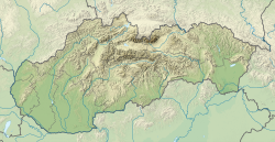
Snakov
Snakov | |
|---|---|
 | |
Location of Snakov in the Prešov Region Location of Snakov in Slovakia | |
| Coordinates: 49°19′N 21°03′E / 49.32°N 21.05°E | |
| Country | |
| Region | |
| District | Bardejov District |
| First mentioned | 1543 |
| Area | |
• Total | 12.14 km2 (4.69 sq mi) |
| Elevation | 459 m (1,506 ft) |
| Population (2021)[3] | |
• Total | 653 |
| Time zone | UTC+1 (CET) |
| • Summer (DST) | UTC+2 (CEST) |
| Postal code | 860 6[2] |
| Area code | +421 54[2] |
| Car plate | BJ |
| Website | www |
Snakov is a village and municipality in Bardejov District in the Prešov Region of north-east Slovakia.
History
[edit]In historical records the village was first mentioned in 1543
Geography
[edit]The municipality lies at an altitude of 450 metres and covers an area of 12.139 km2. It has a population of about 655 people.
In the valley where the source Topľa in its upper reaches, where the main valley ends and forks in the lower valley, near the Polish border, lies the village of Snakov. This village is located in the westernmost part of the Low Beskid, under their principal back, at an altitude of 450 meters. It is located 18 kilometers west of the town Bardejov beside the main road that leads to the Stará Ľubovňa.
Through the village a relatively small stream flows Vesna, which rises near the border with Poland. Vesna is at the crossroads (the "Mlynisko") flows into the Topľa river.
References
[edit]- ^ "Hustota obyvateľstva - obce [om7014rr_ukaz: Rozloha (Štvorcový meter)]". www.statistics.sk (in Slovak). Statistical Office of the Slovak Republic. 2022-03-31. Retrieved 2022-03-31.
- ^ a b c "Základná charakteristika". www.statistics.sk (in Slovak). Statistical Office of the Slovak Republic. 2015-04-17. Retrieved 2022-03-31.
- ^ "Počet obyvateľov podľa pohlavia - obce (ročne)". www.statistics.sk (in Slovak). Statistical Office of the Slovak Republic. 2022-03-31. Retrieved 2022-03-31.


