Sky King Airport
Appearance
Sky King Airport | |||||||||||||||
|---|---|---|---|---|---|---|---|---|---|---|---|---|---|---|---|
| Summary | |||||||||||||||
| Airport type | Public | ||||||||||||||
| Owner | Sky King Airport, Inc. | ||||||||||||||
| Serves | Terre Haute, Indiana | ||||||||||||||
| Elevation AMSL | 496 ft / 151 m | ||||||||||||||
| Coordinates | 39°32′52″N 87°22′38″W / 39.54778°N 87.37722°W | ||||||||||||||
| Maps | |||||||||||||||
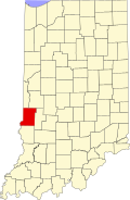
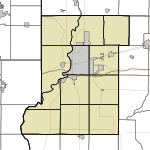
 Location of Vigo County in Indiana | |||||||||||||||
 | |||||||||||||||
| Runways | |||||||||||||||
| |||||||||||||||
| Statistics (2008) | |||||||||||||||
| |||||||||||||||
Sky King Airport (FAA LID: 3I3) is a public use airport located five nautical miles (9 km) north of the central business district of Terre Haute, a city in Vigo County, Indiana, United States.[1]
Facilities and aircraft
[edit]Sky King Airport covers an area of 33 acres (13 ha) at an elevation of 496 feet (151 m) above mean sea level. It has two asphalt paved runways: 8/26 is 3,557 by 50 feet (1,084 x 15 m) and 18/36 is 1,978 by 50 feet (603 x 15 m).[1]
For the 12-month period ending December 31, 2008, the airport had 23,015 aircraft operations, an average of 63 per day: 95% general aviation and 5% air taxi. At that time there were 39 aircraft based at this airport: 87% single-engine and 13% multi-engine.[1]
See also
[edit]References
[edit]External links
[edit]- Brown Flying School, flight school and fixed-base operator (FBO)
- Aerial image as of 24 February 1998 from USGS The National Map
- FAA Terminal Procedures for 3I3, effective October 31, 2024
- Resources for this airport:
- FAA airport information for 3I3
- AirNav airport information for 3I3
- FlightAware airport information and live flight tracker
- SkyVector aeronautical chart for 3I3

