Skatval Municipality
Skatval Municipality
Skatval herred | |
|---|---|
 View of the village of Skatval (front) and surrounding landscape as seen from Forbordsfjellet | |
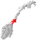
 Nord-Trøndelag within Norway | |
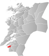
 Skatval within Nord-Trøndelag | |
| Coordinates: 63°30′39″N 10°48′59″E / 63.51083°N 10.81639°E | |
| Country | Norway |
| County | Nord-Trøndelag |
| District | Stjørdalen |
| Established | 1 Jan 1902 |
| • Preceded by | Nedre Stjørdal Municipality |
| Disestablished | 1 Jan 1962 |
| • Succeeded by | Stjørdal Municipality |
| Administrative centre | Skatval |
| Area (upon dissolution) | |
| • Total | 94 km2 (36 sq mi) |
| Population (1962) | |
| • Total | 1,944 |
| • Density | 21/km2 (54/sq mi) |
| Demonym | Skatvalsbygg[1] |
| Time zone | UTC+01:00 (CET) |
| • Summer (DST) | UTC+02:00 (CEST) |
| ISO 3166 code | NO-1715[2] |
Skatval is a former municipality in the old Nord-Trøndelag county, Norway. The 94-square-kilometre (36 sq mi) municipality existed from 1902 until its dissolution in 1962. The municipality encompassed the Skatval peninsula in the northwestern part of what is now the municipality of Stjørdal in Trøndelag county. The administrative centre was the village of Skatval where the Skatval Church is located. Other villages in the Skatval area include Auran, Kvithammer, and Steinvika.[3]


Skatval is divided in several geographical parts listed here counterclockwise from north: Langstein, Nordbygda, Sørbygda, Midtbygda, and Vassbygda. The Skatval peninsula is an important farming area, belonging to the plain districts of Trøndelag. The cultural landscape is dominated in the east by mountainous area with the highest being Forbordsfjellet at 596 metres (1,955 ft) above sea level. The mountaintop is a regional landmark.
History
[edit]The municipality of Skatval was established on 1 January 1902 when the old municipality of Nedre Stjørdal was dissolved and it was divided into three new municipalities: Lånke (population: 1,449), Skatval (population: 2,125), and Stjørdal (population: 3,158). During the 1960s, there were many municipal mergers across Norway due to the work of the Schei Committee. On 1 January 1962, the neighboring municipalities of Hegra (population: 2,704), Lånke (population: 1,967), Skatval (population: 1,944), and Stjørdal (population: 6,204) were all merged to form a new, larger municipality of Stjørdal.[4]
Name
[edit]The municipality (originally the parish) is named after the old Skatval farm (Old Norse: Skataválir) since the first Skatval Church was built there. The first element is skat which means the "outermost end" or "something protruding". This likely is referring to the fact that the local farms lie on a flat surface that juts out at an angle between valley depressions. The last element is the plural form of váll which means "land that's cleared by burning".[5]
Government
[edit]While it existed, this municipality was responsible for primary education (through 10th grade), outpatient health services, senior citizen services, unemployment, social services, zoning, economic development, and municipal roads. During its existence, this municipality was governed by a municipal council of elected representatives, which in turn elected a mayor.[6]
Mayors
[edit]Municipal council
[edit]The municipal council (Herredsstyre) of Skatval was made up of 21 representatives that were elected to four year terms. The party breakdown of the final municipal council was as follows:
| Party name (in Norwegian) | Number of representatives | |
|---|---|---|
| Labour Party (Arbeiderpartiet) | 8 | |
| Centre Party (Senterpartiet) | 10 | |
| Liberal Party (Venstre) | 3 | |
| Total number of members: | 21 | |
| Party name (in Norwegian) | Number of representatives | |
|---|---|---|
| Labour Party (Arbeiderpartiet) | 9 | |
| Farmers' Party (Bondepartiet) | 9 | |
| Liberal Party (Venstre) | 3 | |
| Total number of members: | 21 | |
| Party name (in Norwegian) | Number of representatives | |
|---|---|---|
| Labour Party (Arbeiderpartiet) | 8 | |
| Farmers' Party (Bondepartiet) | 8 | |
| Liberal Party (Venstre) | 4 | |
| Total number of members: | 20 | |
| Party name (in Norwegian) | Number of representatives | |
|---|---|---|
| Labour Party (Arbeiderpartiet) | 7 | |
| Farmers' Party (Bondepartiet) | 9 | |
| Liberal Party (Venstre) | 4 | |
| Total number of members: | 20 | |
| Party name (in Norwegian) | Number of representatives | |
|---|---|---|
| Labour Party (Arbeiderpartiet) | 7 | |
| Farmers' Party (Bondepartiet) | 8 | |
| Liberal Party (Venstre) | 5 | |
| Total number of members: | 20 | |
| Party name (in Norwegian) | Number of representatives | |
|---|---|---|
| Labour Party (Arbeiderpartiet) | 6 | |
| Farmers' Party (Bondepartiet) | 10 | |
| Liberal Party (Venstre) | 4 | |
| Total number of members: | 20 | |
| Note: Due to the German occupation of Norway during World War II, no elections were held for new municipal councils until after the war ended in 1945. | ||
See also
[edit]References
[edit]- ^ "Navn på steder og personer: Innbyggjarnamn" (in Norwegian). Språkrådet.
- ^ Bolstad, Erik; Thorsnæs, Geir, eds. (26 January 2023). "Kommunenummer". Store norske leksikon (in Norwegian). Kunnskapsforlaget.
- ^ Askheim, Svein, ed. (13 December 2017). "Skatval". Store norske leksikon (in Norwegian). Kunnskapsforlaget. Retrieved 26 March 2018.
- ^ Jukvam, Dag (1999). Historisk oversikt over endringer i kommune- og fylkesinndelingen (PDF) (in Norwegian). Statistisk sentralbyrå. ISBN 9788253746845.
- ^ Rygh, Oluf (1903). Norske gaardnavne: Nordre Trondhjems amt (in Norwegian) (15 ed.). Kristiania, Norge: W. C. Fabritius & sønners bogtrikkeri. p. 24.
- ^ Hansen, Tore; Vabo, Signy Irene, eds. (20 September 2022). "kommunestyre". Store norske leksikon (in Norwegian). Kunnskapsforlaget. Retrieved 1 January 2023.
- ^ Arnstad, Per Magnar (2010). Skatval : Vår historiske arv (in Norwegian). Vol. IV. Skatval historielag. ISBN 9788299573580.
- ^ "Kommunevalgene og Ordførervalgene 1959" (PDF) (in Norwegian). Oslo: Statistisk sentralbyrå. 1960. Retrieved 14 April 2020.
- ^ "Kommunevalgene og Ordførervalgene 1955" (PDF) (in Norwegian). Oslo: Statistisk sentralbyrå. 1957. Retrieved 14 April 2020.
- ^ "Kommunevalgene og Ordførervalgene 1951" (PDF) (in Norwegian). Oslo: Statistisk sentralbyrå. 1952. Retrieved 14 April 2020.
- ^ "Kommunevalgene og Ordførervalgene 1947" (PDF) (in Norwegian). Oslo: Statistisk sentralbyrå. 1948. Retrieved 14 April 2020.
- ^ "Kommunevalgene og Ordførervalgene 1945" (PDF) (in Norwegian). Oslo: Statistisk sentralbyrå. 1947. Retrieved 14 April 2020.
- ^ "Kommunevalgene og Ordførervalgene 1937" (PDF) (in Norwegian). Oslo: Statistisk sentralbyrå. 1938. Retrieved 14 April 2020.

