
Sayersville, Texas
Sayersville, Texas | |
|---|---|
 Sayersville  Sayersville | |
| Coordinates: 30°13′55″N 97°19′38″W / 30.23194°N 97.32722°W | |
| Country | United States |
| State | Texas |
| County | Bastrop |
| Elevation | 413 ft (126 m) |
| Time zone | UTC-6 (Central (CST)) |
| • Summer (DST) | UTC-5 (CDT) |
| Area code(s) | 512 & 737 |
| GNIS feature ID | 1346746[1] |
Sayersville is an unincorporated community in Bastrop County, Texas, United States.[1] It is located within the Greater Austin metropolitan area.
History
[edit]The community's original name, Sayers, was changed to Sayersville because there is already a community with this name in Bexar County. Its historical association has been publishing a quarterly bulletin since 1982.[2]
Geography
[edit]Sayersville is located near the east bank of the Big Sandy Creek, one mile west of Texas State Highway 95 and 7 mi (11 km) north of Bastrop in north-central Bastrop County.[3]
Education
[edit]Sayersville had its own school sometime between 1911 and 1916.[3] Today, Sayersville is served by the Elgin Independent School District and Bastrop Independent School District.
References
[edit]- ^ a b U.S. Geological Survey Geographic Names Information System: Sayersville, Texas
- ^ "Sayersville, Texas". Texas Escapes Online Magazine. Retrieved June 19, 2022.
- ^ a b Buder, John J. (June 1, 1995). "Sayersville, TX". tshaonline.org.
Municipalities and communities of Bastrop County, Texas, United States | ||
|---|---|---|
| Cities | 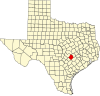 | |
| CDPs | ||
| Other communities | ||
| Ghost towns | ||
| Footnotes | ‡This populated place also has portions in an adjacent county or counties | |
| International | |
|---|---|
| National | |