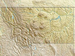
Ruger Lake
Appearance
| Ruger Lake | |
|---|---|
| Location | Glacier National Park, Flathead County, Montana, US |
| Coordinates | 48°44′15″N 113°55′00″W / 48.73750°N 113.91667°W[1] |
| Type | Natural |
| Primary outflows | Camas Creek |
| Basin countries | United States |
| Max. length | .40 mi (0.64 km) |
| Max. width | .20 mi (0.32 km) |
| Surface elevation | 5,802 ft (1,768 m) |
Ruger Lake is located in Glacier National Park, in the U. S. state of Montana. Ruger Lake is situated in the Upper Camas Valley, and is .50 miles (0.80 km) south of Lake Evangeline. Nearby mountains include Longfellow Peak and Paul Bunyans Cabin to the west.[2]
See also
[edit]References
[edit]- ^ "Ruger Lake". Geographic Names Information System. United States Geological Survey, United States Department of the Interior. Retrieved 2011-02-27.
- ^ "Camas Ridge East, MT" (Map (USGS Quad)). TopoQuest. Retrieved 2011-02-27.


