
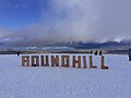
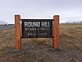
Roundhill Ski Area
| Roundhill Ski Area | |
|---|---|
 View from ski area's car park | |
| Location | Lake Tekapo |
| Nearest major city | Timaru |
| Coordinates | 43°49′32″S 170°39′21″E / 43.825679°S 170.655784°E |
| Vertical | 783 m (2,569 ft) |
| Top elevation | 2,133 m (6,998 ft) |
| Base elevation | 1,350 m (4,430 ft) |
| Skiable area | 550 ha (1,400 acres) |
| Trails | 14 |
| Lift system | 2 T-bars, 1 rope tow, 1 platter lift, 2 beginners rope tows |
| Terrain parks | 1 |
| Snowmaking | Yes |
| Night skiing | No |
| Website | https://www.roundhill.co.nz/ |

5km 3miles T w o
T h u m b R a n g e R i c
h
m o n d R a n g e
Mount Burgess
Mount Edward
Mount Maude
Mount Ardmore
Sugar Loaf
Mount Misery
Mount Musgrave
Neutral Hill
Mount Gerald
Mount Hope
Beuzenberg Peak
Mount Toby
Captains Peak
Mount Caton
The Thumbs
Tantalus
Ajax Peak
Myrmidon
Achilles Peak
Alma
Exeter
Graf Spee
East Sentinel
Mount Earle
Mount Coates
Mount D'Archiac Location of Roundhill Ski Area (red triangle) showing nearby peaks in the Two Thumb Range | |
Roundhill Ski Area is a family owned and run ski area in Canterbury, New Zealand, in the Two Thumb Range near the town of Lake Tekapo, 1.5 hours from Timaru and 4 hours from both Christchurch and Queenstown.
The main runs are accessed by a 1.2 kilometres (0.75 miles) long T-bar (T1) and a shorter T-bar (T2). The ski area caters primarily to beginner and intermediate skiers with extensive use of two snow grooming machines. The base area is at an elevation of 1,350 metres (4,430 feet),[1]: 6 with the T-bars reaching 1,620 metres (5,310 feet). The "Heritage Express" rope tow was added in 2010. This is a steep 1.5 km (0.93 mi) long rope tow rising 630 metres (2,070 feet) to the Richmond Ridge[2] at 2,133 metres (6,998 feet), to give the field 783 metres (2,569 feet) of vertical drop overall; the largest in New Zealand. This opened up a large ungroomed advanced area for skilled skiers and boarders. The Heritage Express was when installed in 2010, claimed to be the longest rope tow in the world at 1,473 m (4,833 ft).[1]: 7 In 2019 it had 6 lifts and was described as having excellent beginner and intermediate terrain with a relatively sunny and warm aspect.[1]: 6, 8
History
[edit]The access road and ski area was first developed in the early 1960's with The Tekapo Ski Club being founded on 25 May 1961.[3] A commercial ski field lease occurred in 1973, with it being known as the Tekapo Ski Field before closing in 1990.[3] The present ski field reopened in 2001.[3] It was operated in 2019 by Tekapo Ski Field Ltd as a concession in part of Te Kahui Conservation Park.[1]: 6 The core lease area is 860 ha (2,100 acres) and there is also a back country ski area lease of 1,520 ha (3,800 acres) without avalanche control.[1]: 7–8 The ski field visitor numbers more than doubled between 2001 and 2018 with its activity contributing to the local economy.[1]: 8
Round Hill
[edit]The ski area is on the southeastern slopes of Round Hill which has a height of 1,588 m (5,210 ft) and the south western slopes of the Richmond and Two Thumb ranges which rise to a height of 2,133 m (6,998 ft) near the ski field.[1]: 70 [4] The higher area is mainly scree above 1,600 m (5,200 ft).[1]: 70 The slopes of Round Hill drain into the Coal River. In the ski run area they are covered in snow tussock Chionochloa macra and some Chionochloa rigida which is mowed on some of the ski runs to minimise the winter snow cover needed for skiing.[1]: 11 Chionochloa macra dominates between 1,600 and 1,300 m (5,200 and 4,300 ft) descending lower on the colder south facing slopes while Chionochloa rigida dominates between 1,300 and 1,000 m (4,300 and 3,300 ft) and tends to be found higher on warmer sunny slopes.[1]: 70 The gentle slopes used for the main ski field are related to underlying extensively oxidised greywacke while the lower western slopes of Round Hill have isolated outcrops of intensely clay altered and variably hematite stained greywacke.[5]: 145 The East Forest Creek Fault runs along the course of the Coal River immediately to the north west of Round Hill.[5]: 148
-
 Roundhill Ski Field (July 2021)
 -
 Roundhill Ski Field (July 2021)
 -
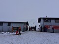 Roundhill Ski Field base buildings (July 2021)


References
[edit]- ^ a b c d e f g h i j "Concession Application Form 3b – Private/commercial facility/structures". Application for a lease/licence by Tekapo Ski Field Limited (Report). Wellington, New Zealand: Department of Conservation. pp. 1–74. Retrieved 1 October 2024.
- ^ "New lift for Roundhill Ski Area"
- ^ a b c "Tekapa Ski Club History". Retrieved 1 October 2024.
- ^ "NZGB Gazetteer – Round Hill". gazetteer.linz.govt.nz. Retrieved 30 September 2024.
- ^ a b Upton, Phædra; Craw, Dave; James, Zoe; Koons, Peter O. (2004). "Structure and late Cenozoic tectonics of the southern Two Thumb range, mid Canterbury,New Zealand". New Zealand Journal of Geology and Geophysics. 47 (1): 141–153. doi:10.1080/00288306.2004.9515043.
External links
[edit]- Roundhill Ski Area, official website
- Trail map