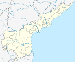
Rajam
Rajam | |
|---|---|
Town | |
| Coordinates: 18°26′52″N 83°39′42″E / 18.447858°N 83.661733°E | |
| Country | India |
| State | Andhra Pradesh |
| District | Vizianagaram district |
| Government | |
| • Type | Nagar Panchayat |
| • Body | Rajam Nagar Panchayat |
| • MLA | Kondru Murali Mohan |
| Area | |
• Total | 32.75 km2 (12.64 sq mi) |
| Elevation | 61 m (200 ft) |
| Population (2011)[3] | |
• Total | 42,197 |
| • Density | 1,300/km2 (3,300/sq mi) |
| Languages | |
| • Official | Telugu |
| Time zone | UTC+5:30 (IST) |
| PIN | 532127 |
| Telephone code | +91–8941 |
| Vehicle Registration | AP30 (Former) AP39 (from 30 January 2019)[4] |
| Website | cdma |
Rajam is a town in Vizianagaram District of the Indian state of Andhra Pradesh. It is a nagar panchayat and the headquarters of Rajam mandal.[5] It is situated at a distance of 51 km from the district headquarters. The place has nostalgic association with Thandra Paparaya, the valiant Sardar of Bobbili and who is credited with slaying of Vijayaramaraju, the Maharaja of Vijayanagaram at the end of the Battle of Bobbili in 1757.[6]
Geography
[edit]Rajam is located at 18.28N 83.40E.[7] It has an average elevation of 42 meters (137 feet).
Demographics
[edit]As of 2011[update] India census, Rajam had a population of 62,197.[3]
Government and politics
[edit]Rajam Nagar panchayat constituted in the year 2005. It is spread over an area of 27.65 km2 (10.68 sq mi) and has 20 election wards.[1] Each represented by a ward member and the wards committee is headed by a chairperson.[8] The present municipal commissioner of the town is Ramesh.[9]
Notable people
[edit]- Grandhi Mallikarjuna Rao – founding chairman of GMR Group
- Pingali Nagendrarao - popular Telugu writer, movie script writer, lyricist
- Harsha Vardhan is an Indian film character actor, comedian and screenwriter known for his works predominantly in Telugu cinema
References
[edit]- ^ a b "STATISTICAL INFORMATION OF ULBs & UDAs" (PDF). Directorate of Town and Country Planning. Government of Andhra Pradesh. p. 1. Retrieved 24 April 2019.
- ^ "Elevation for Rajam". Veloroutes. Retrieved 12 August 2014.
- ^ a b "Census 2011". The Registrar General & Census Commissioner, India. Retrieved 20 July 2014.
- ^ "New 'AP 39' code to register vehicles in Andhra Pradesh launched". The New Indian Express. Vijayawada. 31 January 2019. Archived from the original on 3 February 2019. Retrieved 9 June 2019.
- ^ "List of 26 districts formed in Andhra Pradesh". thehansindia. 26 January 2022.
- ^ https://censusindia.gov.in/2011census/dchb/2811_PART_A_DCHB_SRIKAKULAM.pdf [bare URL PDF]
- ^ Falling Rain Genomics.Razam
- ^ "The Constitution (Seventy-Fourth Amendment) Act, 1992". India Code. Ministry of Law and Justice, Legislative Department. Retrieved 5 November 2016.
- ^ "Municipality Contacts". Archived from the original on 15 May 2015.

