Rahmatabad, Markazi
Rahmatabad
Persian: رحمت اباد | |
|---|---|
Village | |
| Coordinates: 35°24′21″N 50°31′00″E / 35.40583°N 50.51667°E[1] | |
| Country | Iran |
| Province | Markazi |
| County | Zarandiyeh |
| District | Zaviyeh |
| Rural District | Rahmatabad |
| Population (2016)[2] | |
• Total | 553 |
| Time zone | UTC+3:30 (IRST) |
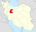
Rahmatabad (Persian: رحمت اباد)[a] is a village in, and the capital of, Rahmatabad Rural District in Zaviyeh District of Zarandiyeh County, Markazi province, Iran.[4]
Demographics
[edit]Ethnicity
[edit]Original inhabitants of the village were from Turkic descendants, immigrated during Seljukians conquests.
During constitutional revolution, the village became surrounded with battlement and gates to serve as a castle for Iran central plateau en route Tehran, new capital for Qajarid monarchy. Afterwards, tribes from other regions including Yazd, Kashan and Shiraz were forced to reside in the village.
The new migrants adopted the inhabitants language and culture, but nowadays resulting from governmental assimilation program, the language and customs have changed to which of Persians.
Population
[edit]At the time of the 2006 National Census, the village's population was 426 in 112 households, when it was in Hakimabad Rural District of the Central District.[5] The following census in 2011 counted 397 people in 126 households.[6] The 2016 census measured the population of the village as 553 people in 188 households.[2]
In 2021, the rural district was separated from the district in the formation of Zaviyeh District, and Rahmatabad Rural District was created in the new district.[4]
See also
[edit]Notes
[edit]References
[edit]- ^ OpenStreetMap contributors (31 January 2025). "Rahmatabad, Zarandiyeh County" (Map). OpenStreetMap (in Persian). Retrieved 31 January 2025.
- ^ a b Census of the Islamic Republic of Iran, 1395 (2016): Markazi Province. amar.org.ir (Report) (in Persian). The Statistical Center of Iran. Archived from the original (Excel) on 17 October 2020. Retrieved 19 December 2022.
- ^ Rahmatabad can be found at GEOnet Names Server, at this link, by opening the Advanced Search box, entering "-3080692" in the "Unique Feature Id" form, and clicking on "Search Database".
- ^ a b Jahangiri, Ishaq (20 July 2021) [Approved 22 February 1400]. Approval regarding the national divisions in Zarandiyeh County, Markazi province. sdil.ac.ir (Report) (in Persian). Ministry of the Interior, Cabinet of Ministers. Proposal 158632; Notification 19320/T58148AH. Archived from the original on 25 September 2021. Retrieved 31 January 2025 – via Shahr Danesh Legal Research Institute.
- ^ Census of the Islamic Republic of Iran, 1385 (2006): Markazi Province. amar.org.ir (Report) (in Persian). The Statistical Center of Iran. Archived from the original (Excel) on 20 September 2011. Retrieved 25 September 2022.
- ^ Census of the Islamic Republic of Iran, 1390 (2011): Markazi Province. irandataportal.syr.edu (Report) (in Persian). The Statistical Center of Iran. Archived from the original (Excel) on 19 January 2023. Retrieved 19 December 2022 – via Iran Data Portal, Syracuse University.


