Quaraí River
| Quaraí River | |
|---|---|
 Aerial view of the Quaraí, or Cuareim River | |
| Location | |
| Country | Uruguay, Brazil |
| Physical characteristics | |
| Mouth | |
• location | Uruguay River |
| Length | 340 km (210 mi)[1] |
| Basin size | 14,750 km2 (5,700 sq mi)[1] |
The Quaraí or Cuareim River (Portuguese Rio Quaraí, Spanish Río Cuareim[2]) is a tributary of the Uruguay River.
Location
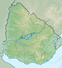
[edit]The river originates in the Coxilha de Santana (Spanish Cuchilla de Santa Ana), an area of low-lying hills, and runs westward to join the Uruguay River. It forms the boundary between Uruguay on the south and Rio Grande do Sul state of Brazil on the north.
Border dispute
[edit]There is a long-standing and unresolved border dispute between Uruguay and Brazil along part of Quaraí River. However, this is not seen as a politically disturbing issue between the two countries, which have close and friendly diplomatic relations and strong economic ties. So far, the disputed areas have been effectively under Brazilian control.
See also
[edit]- List of rivers of Uruguay
- List of rivers of Rio Grande do Sul
- Brazilian Island
- Masoller#Uruguayan-Brazilian border dispute
- Geography of Uruguay#Topography and hydrography
- 1851 Boundary Treaty (Brazil–Uruguay)
30°11′5″S 57°36′18″W / 30.18472°S 57.60500°W[3]
References
[edit]- ^ a b Da Paz et al. (2008) Errors in river lengths derived from raster digital elevation models, Computers & Geosciences 34 (11), pp.1584-1596
- ^ Río Cuareim at GEOnet Names Server
- ^ GNS coordinates adjusted using Google Maps, and GeoLocator

