Porac Airfield
This article includes a list of references, related reading, or external links, but its sources remain unclear because it lacks inline citations. (October 2023) |
Porac Airfield | |
|---|---|
| Part of Fifth Air Force | |
| Coordinates | 15°04′21.43″N 120°32′32.95″E / 15.0726194°N 120.5424861°E |
| Type | Military airfield |
| Site information | |
| Controlled by | United States Army Air Forces |
| Site history | |
| Built | 1940 |
| In use | 1940-1945 |
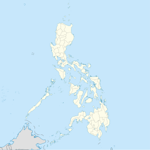
Porac Airfield was a World War II airfield located at Porac to the east of the Porac River in the province of Pampanga on the island of Luzon in the Philippines. It was closed after the war.
History
[edit]Porac Airfield was a single runway airfield prior to the war. A taxiway ran parallel to the runway, with a dispersal area near the northern end of the strip. It was used by the Japanese during their occupation. Late in the war, after liberation, it was used by combined Filipino and American military units in early 1945, such as the USAAF 58th Fighter Group (18 April-10 July 1945), and the 375th Troop Carrier Group (20 May–August 1945). Porac was also used by the 201st Mexican Expeditionary Air Force, flying P-47 Thunderbolts.
The airfield was abandoned after the war and is now part of the town, with the runway being used as a road.
See also
[edit]References
[edit]![]() This article incorporates public domain material from the Air Force Historical Research Agency
This article incorporates public domain material from the Air Force Historical Research Agency
- Maurer, Maurer (1983). Air Force Combat Units Of World War II. Maxwell AFB, Alabama: Office of Air Force History. ISBN 0-89201-092-4.
- www.pacificwrecks.com
External links
[edit]
- Defunct airports in the Philippines
- Airfields of the United States Army Air Forces in the Philippines
- Military history of the Philippines during World War II
- Military facilities in Pampanga
- History of Pampanga
- Military airbases established in 1940
- Asian airport stubs
- Philippine building and structure stubs
- Philippines transportation stubs


