Pennsylvania Route 846
| Route information | ||||
|---|---|---|---|---|
| Maintained by PennDOT | ||||
| Length | 12.41 mi[1] (19.97 km) | |||
| Major junctions | ||||
| South end | ||||
| North end | ||||
| Location | ||||
| Country | United States | |||
| State | Pennsylvania | |||
| Counties | Mercer | |||
| Highway system | ||||
| ||||
Pennsylvania Route 846 (PA 846) is a 12.41-mile-long (19.97 km) state highway located in Mercer County, Pennsylvania. The southern terminus is at PA 718 in Hermitage. The northern terminus is at PA 18 in Greenville.
Route description
[edit]

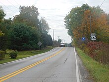
PA 846 begins at an intersection with PA 718 in the city of Hermitage, heading northeast on two-lane undivided River Road. The road runs through a mix of fields and woods with some homes, crossing into South Pymatuning Township. In this area, the route becomes Saranac Drive and continues through rural areas of residential and commercial development. PA 846 turns north and runs between farmland to the west and forested areas of the Shenango Lake Recreation Area. The road curves northeast again and heads into forests of the recreation area, crossing Shenango River Lake. After leaving the recreation area, the route enters a mix of farm fields and woods with some development, continuing into Pymatuning Township. The road heads north again through agricultural areas with a few woods and residences. PA 846 enters West Salem Township and becomes Orangeville Road, making a bend to the northeast. The route continues through rural areas of farms and woods with a few residences for several miles. Upon entering the borough of Greenville, PA 846 becomes Orangeville Street and passes homes, reaching its northern terminus at PA 18.[2][3]
Major intersections
[edit]The entire route is in Mercer County.
| Location | mi[1] | km | Destinations | Notes | |
|---|---|---|---|---|---|
| Hermitage | 0.00 | 0.00 | Southern terminus | ||
| Greenville | 12.41 | 19.97 | Northern terminus | ||
| 1.000 mi = 1.609 km; 1.000 km = 0.621 mi | |||||
See also
[edit]References
[edit]- ^ a b Pennsylvania State Roads - 2010. Harrisburg, Pennsylvania: Pennsylvania Department of Transportation. 2010.
- ^ "overview of Pennsylvania Route 846" (Map). Google Maps. Retrieved May 19, 2011.
- ^ Mercer County, Pennsylvania Highway Map (PDF) (Map). PennDOT. 2011. Retrieved May 19, 2011.[permanent dead link]


