Penanjong Beach
Appearance
| Penanjong Beach | |
|---|---|
| Pantai Penanjong | |
 Penanjong Beach in 2023 | |
| Location | Penanjong, Pekan Tutong, Tutong |
| Nearest city | Bandar Seri Begawan, Brunei-Muara |
| Coordinates | 4°50′24″N 114°40′18″E / 4.8401164°N 114.6717411°E |
| Governing body | Tutong Municipal Department |
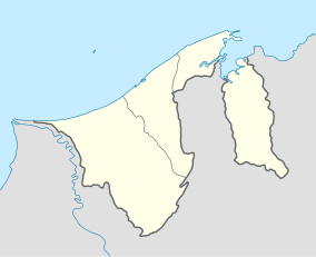
Penanjong Beach (Malay: Pantai Penanjong) is a beach in Kampong Penanjong, Pekan Tutong, Tutong, Brunei Darussalam.[1][2] The beach is known for water sport activities and view of sunsets over the South China Sea.[3] It should also be noted that parts of the beach which stretches from Penanjong are located within a military base.[4]
An average of 8.7% heavy minerals such as quartz were found on the beach.[5][6] On 24 January 2020, Royal Brunei Land Force (RBLF) servicemen from the nearby Penanjong Garrison carried out a cleaning campaign on the beach.[7]
References
[edit]- ^ Wong, Marina (1996). Common seashore life of Brunei. Brunei Museum, Ministry of Culture, Youth and Sports. p. 67.
- ^ Brunei, Muzium (1994). Brunei Museum journal. The Museum. p. 62.
- ^ "Penanjong Beach". 1001beach. Retrieved 3 June 2022.
- ^ Chua, Thia-Eng; Chou, L.M.; Sadorra, Marie Sol M. (1987). The coastal environmental profile of Brunei Darussalam: resource assessment and management issues. WorldFish. p. 83. ISBN 978-971-10-2237-2.
- ^ Sandal, Svein T. (1996). The geology and hydrocarbon resources of Negara Brunei Darussalam. Muzium Brunei. p. 215. ISBN 978-99917-900-0-8.
- ^ Sirinanda, K.U.; Michael, Pangiras (1996). Geography at Universiti Brunei Darussalam: the first decade. Department of Geography, Faculty of Arts and Social Sciences, Universiti Brunei Darussalam. p. 59.
- ^ "KURSUS KEPIMPINAN SARJAN SIRI 2/2019 MENGADAKAN..." ilabdb.MinDef.gov.bn. Retrieved 3 June 2022.

