Paule
Paule
Paoul | |
|---|---|
 The chapel of Lansalaün | |
| Coordinates: 48°14′13″N 3°26′37″W / 48.2369°N 3.4436°W | |
| Country | France |
| Region | Brittany |
| Department | Côtes-d'Armor |
| Arrondissement | Guingamp |
| Canton | Rostrenen |
| Intercommunality | Kreiz-Breizh |
| Government | |
| • Mayor (2023–2026) | Christel Guillerm[1] |
| Area 1 | 37.56 km2 (14.50 sq mi) |
| Population (2021)[2] | 679 |
| • Density | 18/km2 (47/sq mi) |
| Time zone | UTC+01:00 (CET) |
| • Summer (DST) | UTC+02:00 (CEST) |
| INSEE/Postal code | 22163 /22340 |
| Elevation | 108–298 m (354–978 ft) |
| 1 French Land Register data, which excludes lakes, ponds, glaciers > 1 km2 (0.386 sq mi or 247 acres) and river estuaries. | |
Paule (French pronunciation: [pol]; Breton: Paoul) is a commune in the Côtes-d'Armor department in Brittany in northwestern France.
Population
[edit]| Year | Pop. | ±% p.a. |
|---|---|---|
| 1968 | 962 | — |
| 1975 | 811 | −2.41% |
| 1982 | 716 | −1.76% |
| 1990 | 627 | −1.65% |
| 1999 | 652 | +0.44% |
| 2009 | 706 | +0.80% |
| 2014 | 724 | +0.50% |
| 2020 | 682 | −0.99% |
| Source: INSEE[3] | ||
Inhabitants of Paule are called paulois in French.
Geography
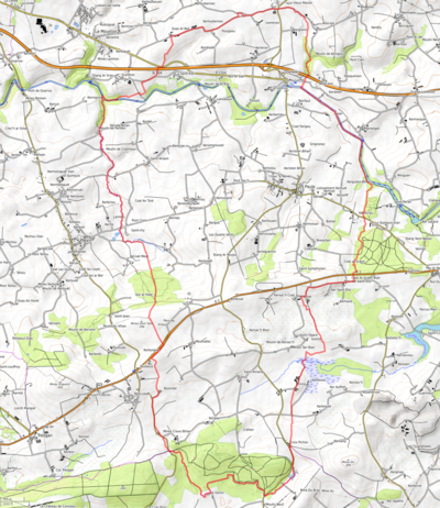
[edit]Paule is located on the northern slope of the Montagnes Noires (french, Black Mountains), 55 km (34 mi) northeast of Quimper. Historically, the village belongs to Cornouaille. Paule is border by Le Moustoir and Maël-Carhaix to the north, by Glomel to the east, by Langonnet to the south and by Plévin to the west. From the hamlet of Bellevue, it is possible to enjoy a nice view on the plain toward the north.
Map
[edit]Prehistory
[edit]The fortified habitat of Paule, a protohistoric Celtic fortress commonly called the fortress of Paule, dates from the 5th century BC. to the 1st century AD. J.-C., on the territory of the Osismes.
See also
[edit]References
[edit]- ^ "Répertoire national des élus: les maires" (in French). data.gouv.fr, Plateforme ouverte des données publiques françaises. 16 April 2024.
- ^ "Populations légales 2021" (in French). The National Institute of Statistics and Economic Studies. 28 December 2023.
- ^ Population en historique depuis 1968, INSEE
External links
[edit]- Paule web site
- Base Mérimée: Search for heritage in the commune, Ministère français de la Culture. (in French)


