P'isqi P'isqi
Appearance
| P'isqi P'isqi | |
|---|---|
 | |
| Highest point | |
| Elevation | 4,600 m (15,100 ft)[1] |
| Coordinates | 15°28′21″S 72°26′50″W / 15.47250°S 72.44722°W |
| Geography | |
| Location | Peru, Arequipa Region, Castilla Province |
| Parent range | Andes |
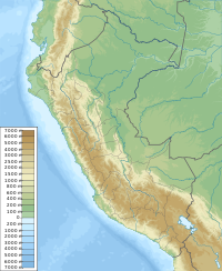
P'isqi P'isqi (Aymara p'isqi white quinoa, Quechua p'isqi a stew or purée of quinua,[2][3][4] the reduplication indicates that there is a group or a complex of something, Hispanicized spelling Pesjepesje) is a mountain in the Andes of Peru, about 4,600 metres (15,092 ft) high. It lies in the Arequipa Region, Castilla Province, Andagua District. P'isqi P'isqi is situated west of Wakapallqa and Llallawi.[1]
References
[edit]- ^ a b escale.minedu.gob.pe - UGEL map of the Castilla Province 1 (Arequipa Region)
- ^ Radio San Gabriel, "Instituto Radiofonico de Promoción Aymara" (IRPA) 1993, Republicado por Instituto de las Lenguas y Literaturas Andinas-Amazónicas (ILLLA-A) 2011, Transcripción del Vocabulario de la Lengua Aymara, P. Ludovico Bertonio 1612 (Spanish-Aymara-Aymara-Spanish dictionary)
- ^ Teofilo Laime Ajacopa (2007). Diccionario Bilingüe: Iskay simipi yuyayk’anch: Quechua – Castellano / Castellano – Quechua (PDF). La Paz, Bolivia: futatraw.ourproject.org.
- ^ Diccionario Quechua - Español - Quechua, Academía Mayor de la Lengua Quechua, Gobierno Regional Cusco, Cusco 2005 (Quechua Spanish dictionary, 5-vowel system)

