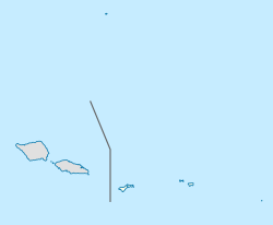
Ottoville, American Samoa
Ottoville, American Samoa | |
|---|---|
Subdivision, or district | |
| Coordinates: 14°20′1″S 170°43′53″W / 14.33361°S 170.73139°W | |
| Country | United States |
| Territory | American Samoa |
| Village | Tafuna |
Ottoville is a subdivision[1] or district[2] within the village of Tafuna, American Samoa.
At Ottoville is the Cathedral of the Holy Family. It contains a picture of the Holy Family on a Samoan beach painted in 1991 by artist Duffy Sheridan. It also includes a 14 deep-relief Stations of the Cross and other woodcarvings made by artist Sven Ortquist, who also designed the cathedral's stained glass windows.[3][4]
Near the Cathedral of the Holy Family and next to the Fatuoaiga Catholic Church is a historical and archeological park which houses a restored Tia Seu Lupe. The park and Tia Seu Lupe Historic Monument was dedicated by Governor Peter Tali Coleman in May 1990. The park sits next to a rainforest reserve.[5][6] This reserve is home to the only low-land rainforest still found on Tutuila Island.[7][8][9]
After the 2009 tsunami, a temporary visitor center for the National Park Service was opened in Ottoville.[10]
As of 2021, Ottoville was one of few areas on Tutuila Island where there were street signs (Ottoville Road). In Ottoville is also Tradewinds Hotel and connecting Equator Restaurant. The hotel has the highest standards on the island, and is also home to a swimming pool and several luxury suites. The hotel offers organized tours of the island the frequently hosts cultural performances on its pavilion. Ottoville is also home to a number of stately homes, rental apartments, modest homes, mini-marts, sewing shops, and warehouses.[11]
Geography
[edit]Ottoville Rainforest
[edit]As of 2002, nearly all forest on the Tafuna Plain had been destroyed, with the exception of the 20-acre (8.1 ha) tract at Ottoville, which was under threat.[12][13] Ottoville Lowland Forest is a 20-acre (8.1 ha) forest reserve situated in central Tafuna Plain, bordered by the Fatuaiga Catholic Compound in the south, and the Ottoville Road and Kanana Fou Theological Seminary in the east. It borders the Kokoland area of Tafuna in the north. The rainforest is dominated by vegetation such as mamalava, tava (Pometia pinnata), and maota trees (Dysoxylum maota). It is the only area remaining of native forest vegetation on the Tafuna Plain. Fourteen bird species have been recorded in the forest, including the common Red-vented Bulbul and the Jungle Myna, which are likely to breed in the forest. Common Myna is abundant in surrounding areas. It is home to the only roost of the White-necked Fruit Bat on the Tafuna Plain.[14]
Tourism
[edit]Tradewinds Hotel has a day spa, resort pool, ATM, car rental, and tour desk. Traditional dancing performances known as fiafia are held here on Friday nights.[15] Equator Restaurant is located at the Tradewinds Hotel and is named for the ship which brought Robert Louis Stevenson to the South Pacific Ocean. The restaurant serves Southern-style shrimp sandwiches, Hawaiian saimin, hamburgers, chicken quesadillas, and more.[16] An additional eatery in Ottoville is Jeffrey's Bar and Grill, which is located near Cost-U-Less and only a five-minute walk away from the Quality Inn Tradewinds Hotel. This restaurant specializes in steaks, but also serves all-day breakfasts, chicken, fish, salads, sandwiches, etc.[17]
Points of interest
[edit]- Holy Family Catholic Cathedral
- Tia Seu Lupe Historic Monument
- Jeffrey's Bar and Grill
- Tradewinds Hotel
- Equator Restaurant
- Church of Jesus Christ of Latter-day Saints at Ottoville
References
[edit]- ^ "ASG-FEMA pre-registration begins today for Tafuna— and subdivisions". Samoa News. 7 March 2018. Retrieved 20 August 2019.
- ^ Swaney, Deanna (1994). Samoa: Western & American Samoa : a Lonely Planet Travel Survival Kit. Lonely Planet Publications. Page 176. ISBN 9780864422255.
- ^ Stanley, David (1999). Moon Handbooks Tonga-Samoa. Moon Travel Guides. Page 177. ISBN 9781566911740.
- ^ Stanley, David (2004). Moon Handbooks South Pacific. Moon Travel Guides. Pages 479-480. ISBN 9781566914116.
- ^ Stanley, David (2004). Moon Handbooks South Pacific. Moon Travel Guides. Page 480. ISBN 9781566914116.
- ^ Swaney, Deanna (1994). Samoa: Western & American Samoa: a Lonely Planet Travel Survival Kit. Lonely Planet Publications. Page 179. ISBN 9780864422255.
- ^ Stanley, David (1999). Moon Handbooks Tonga-Samoa. Moon Travel Guides. Page 177. ISBN 9781566911740.
- ^ Stanley, David (2004). Moon Handbooks South Pacific. Moon Travel Guides. Pages 479-480. ISBN 9781566914116.
- ^ Stanley, David (1996). South Pacific Handbook. David Stanley. Pages 412-413. ISBN 9781566910408.
- ^ "American Samoa | Advisory Council on Historic Preservation". www.achp.gov. Retrieved 20 August 2019.
- ^ Clayville, Melinda (2021). Explore American Samoa: The Complete Guide to Tutuila, Aunu'u, and Manu'a Islands. Pages 61-62. ISBN 9798556052970.
- ^ Whistler, Arthur W. (2002). The Samoan Rainforest: A Guide to the Vegetation of the Samoan Archipelago. Isle Botanica. Page 77. ISBN 9780964542631.
- ^ Todd, Ian (1974). Island Realm: A Pacific Panorama. Angus & Robertson. Page 77. ISBN 9780207127618.
- ^ Trail, Pepper W. (1993). Zoological Survey of the Ottoville Lowland Forest (DMWR Biological Report June 1993). Department of Marine and Wildlife Biological Report Series No. 40.
- ^ "Tradewinds Hotel | Tutuila, American Samoa". www.lonelyplanet.com. Retrieved 20 August 2019.
- ^ "Equator Restaurant American Samoa Restaurants Review". Fodor's Travel. Retrieved 20 August 2019.
- ^ Stanley, David (2004). Moon Handbooks South Pacific. Moon Travel Guides. Page 486. ISBN 9781566914116.

