Offenbeek
Appearance
Offenbeek | |
|---|---|
Village | |
| Coordinates: 51°16′58″N 6°5′43″E / 51.28278°N 6.09528°E | |
| Country | Netherlands |
| Province | Limburg |
| Municipality | Beesel |
| Area | |
| • Total | 2.47 km2 (0.95 sq mi) |
| Elevation | 25 m (82 ft) |
| Population (2021)[1] | |
| • Total | 4,720 |
| • Density | 1,900/km2 (4,900/sq mi) |
| Time zone | UTC+1 (CET) |
| • Summer (DST) | UTC+2 (CEST) |
| Postal code | 5953[1] |
| Dialing code | 077 |
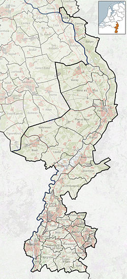
Offenbeek (Limburgish: Óffebek) is a village in the Dutch province of Limburg. It is located in the municipality of Beesel, east of the village of Reuver.[3]
The village was first mentioned in 1289 as de Offenbeke, and means "brook of Offo (person)".[4]
Offenbeek was home to 195 people in 1840. At the end of the 19th century, the village started to industrialise and ceramic factories were opened. In 1964, the Fatima church was built.[5]
References
[edit]- ^ a b c "Kerncijfers wijken en buurten 2021". Central Bureau of Statistics. Retrieved 23 April 2022.
- ^ "Postcodetool for 5953AA". Actueel Hoogtebestand Nederland (in Dutch). Het Waterschapshuis. Retrieved 23 April 2022.
- ^ ANWB Topografische Atlas Nederland, Topografische Dienst and ANWB, 2005.
- ^ "Offenbeek - (geografische naam)". Etymologiebank (in Dutch). Retrieved 23 April 2022.
- ^ "Offenbeek". Plaatsengids (in Dutch). Retrieved 23 April 2022.


