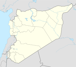
Nahr al-Bared, Syria
Nahr al-Bared
نهر البارد | |
|---|---|
| Coordinates: 35°17′N 36°20′E / 35.283°N 36.333°E | |
| Country | |
| Governorate | Hama |
| District | Al-Suqaylabiyah |
| Subdistrict | Tell Salhab |
| Government | |
| • Mayor | Razoq Mohamad |
| Population (2004)[1] | |
• Total | 4,016 |
Nahr al-Bared (Arabic: نهر البارد) is a village in northwestern Syria, administratively part of the Hama Governorate, located northwest of Hama. It is situated in the al-Ghab plain in the al-Suqaylabiyah District. Nearby localities include Tell Salhab to the south, al-Asharinah to the east, Hawrat Ammorin and al-Suqaylabiyah to the north and al-Mazhal and Ayn al-Kurum to the northwest. According to the Syria Central Bureau of Statistics, Nahr al-Bared had a population of 4,016 in the 2004 census.[1] Its inhabitants are predominantly Alawites.
Landscape
[edit]Although the village is considered modern, it still contains a number of ruins.[citation needed] The village is situated near the Nahr al Bārid river and during the winter regularly receives snow.
Amenities
[edit]Nahr al-Bared has three hotels: Sahara Hotel, Abo Allosh and Abo Maher. There are three mosques in the village: al-Sheikh Abd al-Hadi Haidar, al-Sheikh Soliman Moaala and Ali Naser. The village has a large restaurant which can be accessed by using a micro bus. Nahr al-Bared also contains a large petrol station.
References
[edit]- ^ a b General Census of Population and Housing 2004 Archived 2013-01-13 at archive.today. Syria Central Bureau of Statistics (CBS). Hama Governorate. (in Arabic)
External links
[edit]- "Nahr al Barid, Syria Page". Falling rain Genomics.
- WikiMapia
- Information on the provinces of Syria


