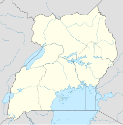
Nagongera
Nagongera | |
|---|---|
| Coordinates: 00°46′12″N 34°01′34″E / 0.77000°N 34.02611°E | |
| Country | Uganda |
| Region | Eastern Uganda |
| District | Tororo District |
| Elevation | 1,136 m (3,727 ft) |
| Population (2020 Estimate) | |
• Total | 14,300[1] |
| Time zone | UTC+3 (EAT) |
Nagongera is a town in Tororo District, in the Eastern Region of Uganda.[2]
Location
[edit]Nagongera is located approximately 26.5 kilometres (16 mi) west of Tororo, the location of the district headquarters.[3] This is about 46 kilometres (29 mi) south-west of Mbale, the largest city in the Eastern Region of Uganda.[4] Nagongera is approximately 261 kilometres (162 mi) north-east of Kampala, the capital and largest city of Uganda.[5] The coordinates of the town are 00°46'12.0"N, 34°01'34.0"E (Latitude:0.7700; Longitude:34.0261).[6] Nagongera Town Council sits at an average elevation of 1,136 metres (3,727 ft) above mean sea level.[citation needed]
Population
[edit]In 2014, the national census and household survey enumerated the population of Nagongera at 12,341.[7]
In 2015, the Uganda Bureau of Statistics (UBOS), estimated the population of Nagongera Municipal Council at 12,600. In 2020, the population agency estimated the mid-year population of the municipality at 14,300 people. Of these, 7,300 (51 percent) were females and 7,000 (49 percent) were males. UBOS calculated the population growth rate of Nagongera Town to average 2.56 percent annually, between 2015 and 2020.[1]
Overview
[edit]Nagongera attained municipality status in 2006. Up until that time, the town had no piped running water.[8] That year, the Directorate of Water Development of the Uganda Ministry of Water and Environment, started the piped water project for Nagongera, using capital of USh700 million (about US$200,000 at that time).[8]
Points of interest
[edit]The following points of interest lie in or near Nagongera:[6]
1. The offices of Nagongera Town Council
2. Nagongera Central Market
3. Nagongera Train Station
4. The town of Nagongera is the location of one of the campuses of Busitema University, a public university in Uganda.[9]
5. Nagongera Health Centre IV[10]
Notable Resident
[edit]- Paskar Owor, middle-distance runner
See also
[edit]References
[edit]- ^ a b Uganda Bureau of Statistics (14 June 2020). "Estimated Population of Nagongera Town Council" (Citypopulation.de Quoting Uganda Bureau of Statistics). Citypopulation.de. Retrieved 18 January 2021.
- ^ Places In The World (18 January 2021). "Nagongera Town Council is a municipality in West Budama (Kisolo) in Tororo District in Eastern Region in Uganda". Places In The World. Retrieved 18 January 2021.
- ^ "Distance Between Tororo, Eastern Region, Uganda And Nagongera, Tororo District, Eastern Region, Uganda" (Map). Google Maps. Retrieved 18 January 2021.
- ^ "Distance Between Nagongera, Tororo District, Eastern Region, Uganda and Mbale, Eastern Region, Uganda" (Map). Google Maps. Retrieved 18 January 2021.
- ^ "Road Distance Between Kampala, Central Region, Uganda And Nagongera, Tororo District, Eastern Region, Uganda" (Map). Google Maps. Retrieved 18 January 2021.
- ^ a b "Location of Nagongera, Eastern Region, Uganda" (Map). Google Maps. Retrieved 18 January 2021.
- ^ Uganda Bureau of Statistics (14 June 2020). "The population of all Ugandan cities and towns with more than 15,000 inhabitants according to census results and latest official projections" (Citypopulation.de Quoting Uganda Bureau of Statistics). Citypopulation.de. Retrieved 18 January 2021.
- ^ a b "Nagongera Town Council In Tororo District Is Set To Get Tap Water That Will Benefit Over 30,000 People". New Vision.
- ^ NatureUganda (21 February 2014). "NatureUganda Launches Busitema University Branch". NatureUganda.org. Retrieved 23 June 2016.
- ^ Kate Zinszer; et al. (10 January 2014). "Determining health-care facility catchment areas in Uganda using data on malaria-related visits". Bulletin of the World Health Organization. 92 (3). Geneva: 178–186. doi:10.2471/BLT.13.125260 (inactive 5 December 2024). PMC 3949593. PMID 24700977. Archived from the original on October 11, 2014. Retrieved 23 June 2016.
{{cite journal}}: CS1 maint: DOI inactive as of December 2024 (link)


