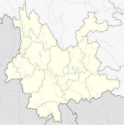
Mujia Township
Mujia Township
木戛乡 | |
|---|---|
| Tai Nuea transcription(s) | |
| • Tai Le | ᥛᥫᥒᥰ ᥐᥣᥐᥱ |
Etymology:
| |
| Coordinates: 22°59′31″N 99°38′04″E / 22.99194°N 99.63444°E | |
| Country | People's Republic of China |
| Province | Yunnan |
| Prefecture-level city | Pu'er City |
| Autonomous county | Lancang Lahu Autonomous County |
| Area | |
• Total | 278 km2 (107 sq mi) |
| Population (2017) | |
• Total | 16,113 |
| • Density | 58/km2 (150/sq mi) |
| Time zone | UTC+08:00 (China Standard) |
| Postal code | 665605 |
| Area code | 0879 |
Mujia Township (simplified Chinese: 木戛乡; traditional Chinese: 木戛鄉; pinyin: Mùjiā Xiāng; Tai Nüa: ᥛᥫᥒᥰ ᥐᥣᥐᥱ) is a township in Lancang Lahu Autonomous County, Yunnan, China. As of the 2017 census it had a population of 16,113 and an area of 278-square-kilometre (107 sq mi).
Etymology
[edit]"Mujia" is a Tai Nuea language name, which means "place like a spoon", written in Tai Le script as ᥛᥫᥒᥰ ᥐᥣᥐᥱ. The original pronunciation is "Mengga", but now evolved to "Mujia".[1] Another said, "Mujia" is a Wa language name, which means "place with many of wild ginger", and written in Wa language as "ndaex glag".[2]
Administrative division
[edit]As of 2016, the township is divided into six villages:
- Bangli (邦利村)
- Mengnuo (勐糯村)
- Haboma (哈卜吗村)
- Laba (拉巴村)
- Nanliu (南六村)
- Fujiao (富角村)
Geography
[edit]The township is situated at northwestern Lancang Lahu Autonomous County.[3] The township shares a border with Xuelin Wa Ethnic Township to the west, Shangyun Town and Fubang Township to the east, Ankang Wa Ethnic Township to the north, and Zhutang Township to the south.[3]
There are four major streams in the township, namely the Nanjia Stream (南戛河), Napi Stream (拿丕河), Nanla Stream (南拉河), and Waluoma Stream (瓦洛吗河).[3] They are tributaries of the Black River (黑河).[3]
The highest point in the township is Hanima Mountain (哈尼吗山), which, at 2,314 metres (7,592 ft) above sea level.
Economy
[edit]The economy of the township is largest based on agriculture, including farming and pig-breeding.[4] The main crops of the region are grain, followed by corn and wheat.[4] Commercial crops include tea and beans.[4]
Demographics
[edit]| Year | Pop. | ±% |
|---|---|---|
| 2004 | 16,589 | — |
| 2017 | 16,113 | −2.9% |
| Source: [4] | ||
As of 2017, the National Bureau of Statistics of China estimates the township's population now to be 16,113.
| Ethnic groups in 2004[4] | ||
|---|---|---|
| Ethnicity | Population | Percentage |
| Lahu | 16,210 | 97.7% |
| Han | 321 | 1.9% |
| Other | 58 | 0.3% |
Transportation
[edit]The National Highway G214 passes across the township.
References
[edit]Citations
[edit]- ^ People's Government of Lancang Lahu Autonomous County (1986). 云南省澜沧拉祜族自治县地名志 [Toponymy Dictionary of Lancang Lahu Autonomous County, Yunnan]. pp. 74–75.
- ^ Wang Jingliu (2014). 佤汉大词典 [Wa - Chinese Dictionary]. Kunming: Yunnan Nationalities Publishing House. p. 1042. ISBN 978-7-5367-6031-8.
- ^ Jump up to: a b c d Shi Chunyun 2007, p. 58.
- ^ Jump up to: a b c d e Shi Chunyun 2007, p. 59.
General bibliography
[edit]- Shi Chunyun, ed. (2007). "Administrative divisions" 行政区划. 《澜沧拉祜族自治县概况》 [General Situation of Lancang Lahu Autonomous County] (in Chinese). Beijing: Nationalities Publishing House. ISBN 978-7-105-08556-9.


