Minstrel Island Water Aerodrome
Appearance
Minstrel Island Water Aerodrome | |||||||||||
|---|---|---|---|---|---|---|---|---|---|---|---|
| Summary | |||||||||||
| Airport type | Public | ||||||||||
| Operator | Grant Douglas | ||||||||||
| Location | Minstrel Island | ||||||||||
| Time zone | PST (UTC−08:00) | ||||||||||
| • Summer (DST) | PDT (UTC−07:00) | ||||||||||
| Elevation AMSL | 0 ft / 0 m | ||||||||||
| Coordinates | 50°37′N 126°19′W / 50.617°N 126.317°W | ||||||||||
| Map | |||||||||||
 | |||||||||||
| Runways | |||||||||||
| |||||||||||
Source: Water Aerodrome Supplement[1] | |||||||||||
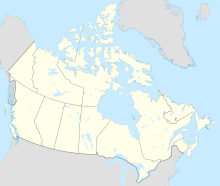
Minstrel Island Water Aerodrome, formerly TC LID: CAX7, was a public airport located adjacent to Minstrel Island, British Columbia, Canada. Minstrel Island is on the south side of the lower reaches of Knight Inlet and is to the north of East Cracroft Island.
References
[edit]- ^ Nav Canada's Water Aerodrome Supplement. Effective 0901Z 26 March 2020 to 0901Z 22 April 2021.


