Mauléon Aerodrome
This article needs additional citations for verification. (January 2019) |
Mauléon Aerodrome | |||||||||||
|---|---|---|---|---|---|---|---|---|---|---|---|
| Summary | |||||||||||
| Coordinates | 46°54′10″N 000°41′52″W / 46.90278°N 0.69778°W | ||||||||||
| Map | |||||||||||
 | |||||||||||
| Runways | |||||||||||
| |||||||||||
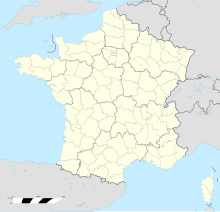
Mauléon Aerodrome (ICAO: LFJB) is a civil airfield, open to public aeronautical circulation (CAP)1,[1] located 4 kilometres (2.5 mi) east-south-east of Mauléon, Deux-Sèvres in the Nouvelle-Aquitaine region of France.
This airfield is used for leisure activities and tourism (light aviation and helicopter).
History
[edit]Near the airfield runway, the Bocage flying club was created in 1983. In 2014, an ultralight aviation section was created.
Facilities
[edit]The airfield has one asphalt paved runway, designated 04/22, which measures 1,300 by 20 metres (4,265 by 66 ft).
It has a diurnal and nocturnal marking (low intensity lights).
The aerodrome is not controlled. Communications are carried out in self-information on the frequency of 123.500 MHz.
It is approved with limitations for night visual flight rules (VFR) flight.
Added to this are present:
See also
[edit]References
[edit]- ^ List of aerodromes authorised to be established and put into service, list No 1: Aerodromes open to public air traffic (Official Journal No 0159 of 10 July 2012, p. 11268)
- ^ The aeronautical information contained in this section is quoted without any guarantee of regular updates. Only information published by the Aeronautical Information Service (AIS) and/or the aerodrome manager may be used for air navigation.
External links
[edit]

