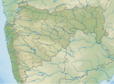
Lower Wardha Dam
Appearance
| Lower Wardha Dam | |
|---|---|
| Official name | Lower Wardha Dam D03003 |
| Location | Dhanodi near Arvi in Wardha District |
| Coordinates | 20°52′44″N 78°16′06″E / 20.8787815°N 78.2684469°E |
| Owner(s) | Government of Maharashtra, India |
| Dam and spillways | |
| Type of dam | Earthfill Gravity |
| Impounds | Wardha River |
| Height | 27.8 m (91 ft) |
| Length | 9,464 m (31,050 ft) |
| Dam volume | 2,639 km3 (633 cu mi) |
| Reservoir | |
| Total capacity | 216,870 km3 (52,030 cu mi) |
| Surface area | 54,654 km2 (21,102 sq mi) |
Lower Wardha Dam is an earthfill and gravity dam on Wardha river at Varud (Baggaji) Dhanodi near Arvi in Wardha district but falls under Amravati district in the state of Maharashtra in India.[1]
Specifications
[edit]The height of the dam above lowest foundation is 27.8 m (91 ft) while the length is 9,464 m (31,050 ft). The volume content is 2,639 km3 (633 cu mi) and gross storage capacity is 253,340.00 km3 (60,779.50 cu mi).[2]
This project's initial contract value is INR 417.30 Millions.[3]
Location
[edit]This dam is located at 20.877819, 78.259821 close to a village named Dhanodi near Arvi, in Wardha District of the state of Maharashtra.
Purpose
[edit]- Irrigation and water supply
See also
[edit]References
[edit]- ^ "Lower Wardha D03003". Archived from the original on 2 April 2015. Retrieved 1 March 2013.
- ^ Specifications of large dams in India Archived 21 July 2011 at the Wayback Machine
- ^ APR Constructions - Spillway of Lower Wardha Dam

