Klock Hill
Appearance
| Klock Hill | |
|---|---|
| Highest point | |
| Elevation | 2,021 feet (616 m) |
| Coordinates | 42°43′05″N 75°08′39″W / 42.71806°N 75.14417°W[1] |
| Geography | |
| Location | Burlington, New York, U.S. |
| Topo map | USGS Edmeston |
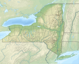
Klock Hill is a mountain located in Central New York region of New York southwest of Burlington, New York.[2]
Once claimed as the highest point in Otsego County, a century ago they even had a wooden observation tower built for tourists and were locked in bitter debate with folks in Maryland that claimed Hooker Mountain was tallest. Actually named for a resident whose name was "Klock".
References
[edit]- ^ "Klock Hill". Geographic Names Information System. United States Geological Survey, United States Department of the Interior. Retrieved June 3, 2017.
- ^ "Klock Hill". Geonames.usgs. usgs. 1980. Retrieved June 3, 2017.
data


