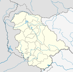
Khore, India
Appearance
Khore | |
|---|---|
Tehsil | |
| Coordinates: 32°50′46″N 74°27′36″E / 32.846°N 74.460°E | |
| Country | India |
| Union Territory | Jammu and Kashmir |
| District | Jammu |
| Population (2011) | |
• Total | 6,931 |
| Languages | |
| • Official | English, Dogri |
| Time zone | UTC+5:30 (IST) |
Khore is a town in Jammu district in the Indian union territory of Jammu and Kashmir. It is located close to the Line of Control.
Demographics
[edit]As of 2011[update] India census,[1] Khour had a population of 6,931 with 1,592 no of households. Males constitute 51% of the population and females 49%. Khour has an average literacy rate of 82.31%, higher than the national average of 74%: male literacy is 89.46%, and female literacy is 75.14%. In Khour , 12.23% of the population is under 6 years of age.[2]
According to the 2011 census, 98.11% of the population was Hindu, with the remainder mostly being made up by Muslims (0.79%), Christians (0.72%) and Sikhs (0.13%).[3]
Religion in Khour (2011)[4]
Hinduism (98.11%)
Islam (0.79%)
Christianity (0.72%)
Sikhism (0.13%)
Not Stated (0.25%)
References
[edit]- ^ "Census of India 2001: Data from the 2001 Census, including cities, villages and towns (Provisional)". Census Commission of India. Archived from the original on 16 June 2004. Retrieved 1 November 2008.
- ^ "District Census Handbook: Jammu," Page 85, Census of India 2011, Directorate of Census Operations, Jammu and Kashmir, Government of India, 2011
- ^ "Khour City Population - Jammu, Jammu & Kashmir". Censusindia2011.com. Retrieved 21 November 2021.
- ^ "Khour town Population". Census India. Retrieved 21 November 2021.


