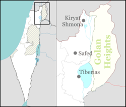
Kfar Shamai
Kfar Shamai | |
|---|---|
 | |
| Coordinates: 32°57′24″N 35°27′25″E / 32.95667°N 35.45694°E | |
| Country | Israel |
| District | Northern |
| Council | Merom HaGalil |
| Affiliation | Hapoel HaMizrachi |
| Founded | 1949 |
| Founded by | Immigrants from Yemen |
| Population (2022)[1] | 565 |

Kfar Shamai (Hebrew: כפר שמאי) is a moshav in northern Israel. Located in Upper Galilee, about 1.9 miles (3 km) west of Safed, it falls under the jurisdiction of Merom HaGalil Regional Council. In 2022 it had a population of 565.[1]
History
[edit]The moshav was founded in 1949 by immigrants from Yemen. It was built over the Palestinian village of al-Sammu'i that was depopulated during the 1948 war[2] as part of Israel's Independence war. Most of these immigrants have stayed. Over the years immigrants from Romania and Morocco joined them. Today, 2006, the moshav houses a museum for the preservation of local history since its establishment.
The name "Kfar Shamai" is based on Shammai the Elder, who was the partner of Hillel the Elder. According to Jewish tradition, Shammai was buried in Har Meron or in "Shammai Hill" near the community.[3]
References
[edit]- ^ a b "Regional Statistics". Israel Central Bureau of Statistics. Retrieved 21 March 2024.
- ^ Yalqut Teiman, Yosef Tobi and Shalom Seri (editors), Tel-Aviv 2000, p. 131, s.v. כפר שמאי (Hebrew) ISBN 965-7121-03-5
- ^ Hareouveni, Emanouel (1974). The Settlements of Israel and Their Archaelogical sites (in Hebrew). Israel: Hakibbutz Hameuchad. p. 190

