Kaka, Arizona
Kaka, Arizona
O'odham: Gagka | |
|---|---|
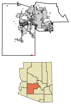
 Location in Maricopa County, Arizona | |
| Coordinates: 32°30′41″N 112°18′59″W / 32.51139°N 112.31639°W | |
| Country | United States |
| State | Arizona |
| County | Maricopa |
| Area | |
• Total | 0.50 sq mi (1.29 km2) |
| • Land | 0.50 sq mi (1.29 km2) |
| • Water | 0.00 sq mi (0.00 km2) |
| Elevation | 2,251 ft (686 m) |
| Population | |
• Total | 83 |
| • Density | 167.00/sq mi (64.48/km2) |
| Time zone | UTC-7 (MST (no DST)) |
| Area code | 928 |
| FIPS code | 04-36780 |
| GNIS feature ID | 2582804[2] |
Kaka (O'odham: Gagka, translates as "A Clearing") is a census-designated place (CDP) in Maricopa County, Arizona, United States, located in the Tohono O'odham Nation. The population was 83 at the 2020 census,[3] down from 141 at the 2010 census.
Toponymy
[edit]It has frequently been noted on lists of unusual place names.[4]
Geography
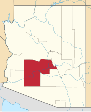
[edit]Kaka is in southernmost Maricopa County, nearly touching the border with Pima County. It is 88 miles (142 km) south-southwest of Phoenix, 106 miles (171 km) west-northwest of Tucson, and 67 miles (108 km) northeast of the Mexican border at Lukeville.
Demographics
[edit]At the 2020 census there were 83 people and 28 households living in the CDP.[3][5]
The median household income was $39,573. The per capita income for the CDP was $13,965.[6]
| Census | Pop. | Note | %± |
|---|---|---|---|
| 2010 | 141 | — | |
| 2020 | 83 | −41.1% | |
| U.S. Decennial Census[7] | |||
As of the census[8] of 2010, there were 141 people living in the CDP. The population density was 545.0 people per square mile. The racial makeup of the CDP was 99% Native American and 1% from some other race. 6% of the population were Hispanic or Latino of any race.
References
[edit]- ^ "2021 U.S. Gazetteer Files: Arizona". United States Census Bureau. Retrieved May 16, 2022.
- ^ a b U.S. Geological Survey Geographic Names Information System: Kaka, Arizona
- ^ a b c "Kaka CDP, Arizona: 2020 DEC Redistricting Data (PL 94-171): P1. Race". U.S. Census Bureau. Retrieved May 16, 2022.
- ^ Parker, Quentin (2010). Welcome to Horneytown, North Carolina, Population: 15: An insider's guide to 201 of the world's weirdest and wildest places. Adams Media. p. x. ISBN 9781440507397.[permanent dead link]
- ^ "Kaka CDP, Arizona: 2020 DEC Redistricting Data (PL 94-171): H1. Occupancy statistics". U.S. Census Bureau. Retrieved May 16, 2022.
- ^ "Kaka, AZ Profile: Facts & Data". Arizona.hometownlocator.com. 2021. Retrieved August 24, 2021.
- ^ "Census of Population and Housing". Census.gov. Retrieved June 4, 2016.
- ^ "American FactFinder". Archived from the original on July 21, 2011. Retrieved April 23, 2011.


