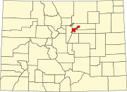
Harvey Park, Denver
Harvey Park is a neighborhood in Denver, Colorado. As of the 2020 U.S. Census, the population of the neighborhood was 11,496.[1]
Geography
[edit]Harvey Park is a neighborhood as defined by the City and County of Denver. There are a number of conflicting maps of the neighborhood. However, the city's Community and Development department lists the official boundaries as follows.[2]
East of South Sheridan Boulevard
[edit]- North – Jewell Avenue
- West – South Sheridan Boulevard
- East – South Lowell Boulevard
- South – Yale Avenue
West of South Sheridan Boulevard
[edit]- North – Jewell Avenue; West Green Meadows Place
- West – South Depew Street; South Harlan Street
- East – South Sheridan Boulevard
- South – West Warren Avenue
There are three lakes in Harvey Park:
- Harvey Park Lake
- Riviera Lake
- Wolcott Lake
The similarly named neighborhood Harvey Park South borders Harvey Park directly to the south.[2]
History
[edit]The 160 acres that makes up present-day was part of “Whiteman’s Black and White Ranch,” owned by jazz musician Paul Whiteman.[3] In 1948, American businessman Arthur Harvey purchased the land, along with 320 acres of Arapahoe County, Colorado.[3] In March 1953, homeowners in Harvey Park petitioned the city of Denver for annexation, and the neighborhood was officially annexed in March 1954.[3] The firm C. Burns Realty & Trust constructed a model village of three homes in November 1954 at the intersection of Harvard Avenue and Lowell Boulevard.[4] The builders of the neighborhood were Lou Carey, K.C. Ensor, and Thomas Hutchison.[3] Nearly 4,000 homes were built in Harvey Park between 1954 and 1957.[5]
Architecture
[edit]The Harvey Park Neighborhood is primarily residential, with single-family homes built mostly in a Mid-century modern architectural style. There are homes built by noteworthy architects of the period, such as Cliff May and Chris Choate.[6] In Harvey Park, there are 170 homes built by Cliff May alone.[7] The majority of homes in Harvey Park were built between 1954 and 1965.[6] In 2016, Historic Denver piloted its Discover Denver program, a survey of the city's historic homes.[6] The organization later listed the Cliff May homes on its "50 Actions for 50 Places" list for historic preservation.[8]
Schools
[edit]- Doull Elementary School (opened 1956)[3]
- Kunsmiller Creative Arts Academy
- Notre Dame Catholic School
Registered Neighborhood Organization (RNO)
[edit]The RNO for the Harvey Park Neighborhood is the Harvey Park Community Organization (HPCO) — formerly known as the Harvey Park Improvement Association (HPIA).[9]
See also
[edit]- Bibliography of Colorado
- Geography of Colorado
- History of Colorado
- Index of Colorado-related articles
- List of Colorado-related lists
- Outline of Colorado
References
[edit]- ^ "2020 Census Demographic Data Map Viewer". maps.geo.census.gov. Retrieved 2024-09-19.
- ^ a b "Denver Maps - Neighborhoods". www.denvergov.org. Retrieved 2024-09-14.
- ^ a b c d e Ugarte, Jessica Aurora (24 November 2014). "Survey Report Pilot Area #1 Harvey Park" (PDF). Discover Denver. Retrieved 16 September 2024.
- ^ Salutz, Alison (2024-07-31). "Cliff May Homes, Harvey Park". Historic Denver. Retrieved 2024-09-14.
- ^ Post, Elana Ashanti Jefferson | The Denver (2012-09-28). "Charms and challenges in Denver's best kept "mid-mod" secret". The Denver Post. Retrieved 2024-09-14.
- ^ a b c "Could your Denver home be historic? Group launches survey". The Denver Post. 2013-09-06. Retrieved 2024-09-14.
- ^ Thomson, Amy (June 7, 2017). "Inside the Unique Architectural History of Denver's Harvey Park". 5280 Magazine. 5280 Publishing, Inc. Retrieved September 14, 2024.
- ^ "Historic Denver reveals 50 Actions for 50 Places". Denver 7 Colorado News (KMGH). 2021-08-03. Retrieved 2024-09-14.
- ^ "Denver Maps - Registered Neighborhood Organizations". www.denvergov.org. Retrieved 2024-09-14.
External links
[edit]
39°40′38″N 105°02′24″W / 39.6772°N 105.0401°W

