
Hadseløya
 | |
 | |
| Geography | |
|---|---|
| Location | Nordland, Norway |
| Coordinates | 68°32′44″N 14°42′03″E / 68.5455°N 14.7009°E |
| Archipelago | Vesterålen |
| Area | 102 km2 (39 sq mi) |
| Length | 16 km (9.9 mi) |
| Width | 10 km (6 mi) |
| Highest elevation | 657 m (2156 ft) |
| Highest point | Lamlitinden |
| Administration | |
Norway | |
| County | Nordland |
| Municipality | Hadsel Municipality |
Hadseløya (Norwegian) or Ulbi (Northern Sami)[1] is an island in Hadsel Municipality in Nordland county, Norway. It is located in the Vesterålen region on the north side of the Hadselfjorden. The town of Stokmarknes is situated on the northern shore of the island and the village of Melbu is on the southern coast.
The island has an area of 102 square kilometres (39 sq mi). The 657-metre (2,156 ft) tall mountain Lamlitinden is the highest point on the island. Hadseløya is connected to the neighboring islands of Langøya and Børøya by the Hadsel Bridge. There is also a ferry connection from the village of Melbu to the village of Fiskebøl on Austvågøya island to the south.[2]
-
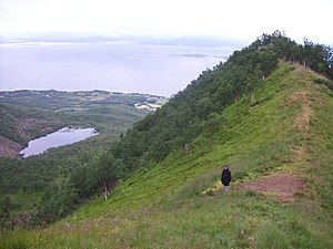 View from mountain on Hadseløya
 -
 Taen beach on Hadseløya
 -
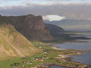 Aerial view of the western coast of the island


See also
[edit]References
[edit]- ^ "Informasjon om stadnamn". Norgeskart (in Norwegian). Kartverket. Retrieved 2024-08-13.
- ^ Store norske leksikon. "Hadseløya" (in Norwegian). Retrieved 2012-07-22.
External links
[edit]
This article about an island in Nordland is a stub. You can help Wikipedia by expanding it. |