Gumyōji Station (Yokohama Municipal Subway)
Appearance
B12 Gumyōji Station 弘明寺駅 | |||||||||||
|---|---|---|---|---|---|---|---|---|---|---|---|
 Entrance 2B in November 2020 | |||||||||||
| General information | |||||||||||
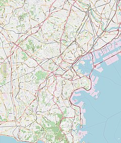
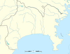
| Location | Tōrichō 4-114, Minami, Yokohama, Kanagawa (横浜市南区通町四丁目114) Japan | ||||||||||
| Operated by | Yokohama City Transportation Bureau | ||||||||||
| Line(s) | |||||||||||
| Distance | 15.4 km (9.6 mi) from Shōnandai | ||||||||||
| Platforms | 2 side platforms | ||||||||||
| Tracks | 2 | ||||||||||
| Other information | |||||||||||
| Station code | B12 | ||||||||||
| History | |||||||||||
| Opened | December 16, 1972 | ||||||||||
| Passengers | |||||||||||
| 2008 | 8,558 daily | ||||||||||
| Services | |||||||||||
| |||||||||||
| |||||||||||
Gumyōji Station (弘明寺駅, Gumyōji-eki) is an underground metro station located in Minami-ku, Yokohama, Kanagawa, Japan operated by the Yokohama Municipal Subway’s Blue Line (Line 1). Note that Gumyōji Station of the Keikyū Main Line is located about 500 m away, on the other side of the Gumyōji Kannon Shopping Street (弘明寺かんのん通り商店街).
Lines
[edit]Station layout
[edit]Gumyōji Station is an underground station with two opposed side platforms serving two tracks.
Platforms
[edit]| 1 | ■ Blue Line (Yokohama) | Kamiōoka, Totsuka, Shōnandai |
| 2 | ■ Blue Line (Yokohama) | Kannai, Yokohama, Shin-Yokohama, Azamino |
-
Ticket gates
-
Platform
History
[edit]Gumyōji Station was opened on 16 December 1972. Platform screen doors were installed in September of 2007.
References
[edit]- Harris, Ken and Clarke, Jackie. Jane's World Railways 2008-2009. Jane's Information Group (2008). ISBN 0-7106-2861-7
Wikimedia Commons has media related to Gumyōji Station (Yokohama Municipal Subway).
External links
[edit]- Gumyōji Station (Blue Line) (in Japanese)


