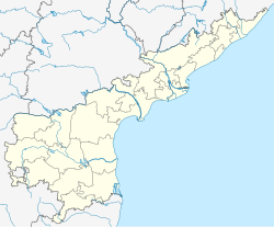
Gudipudi
This article needs additional citations for verification. (June 2014) |
Gudipudi | |
|---|---|
Village | |
 Dynamic map | |
| Coordinates: 16°31′N 79°44′E / 16.52°N 79.74°E | |
| Country | India |
| State | Andhra Pradesh |
| District | Palnadu |
| Mandal | Sattenapalle |
| Government | |
| • Type | Panchayati raj |
| • Body | Gudipadu gram panchayat |
| Area | |
• Total | 1,782 ha (4,403 acres) |
| Population (2011)[3] | |
• Total | 5,471 |
| • Density | 310/km2 (800/sq mi) |
| Languages | |
| • Official | Telugu |
| Time zone | UTC+5:30 (IST) |
| PIN | 522xxx |
| Area code | +91–8640 |
| Vehicle registration | AP |
Gudipudi is a village in Palnadu district of the Indian state of Andhra Pradesh. It is located in Sattenapalle mandal of Guntur revenue division.[4][5]
Geography
[edit]Gudipudi is located at coordinates 16°25'7"N 80°21'57"E geographically.
Demography
[edit]Telugu is the local language. The village of Gudipudi covers an area of about 1782 hectares. As of 2011 India census, Gudipudi had a population of 5587, with 2783 men and 2804 women living in 1372 houses.[6]
Government and politics
[edit]Gudipudi gram panchayat is the local self-government of the village.[7] The panchayat is divided into wards and each ward is represented by an elected ward member. These ward members are headed by a sarpanch. [8] The present sarpanch of the gram panchayat is Dasari Vijaya Raju, who got elected in the year 2013.[9] The village forms a part of Andhra Pradesh Capital Region and is under the jurisdiction of APCRDA.[10]
References
[edit]- ^ "Gram Panchayat Identification Codes" (PDF). Saakshar Bharat Mission. National Informatics Centre. p. 119. Archived from the original (PDF) on 18 August 2017. Retrieved 7 May 2019.
- ^ "District Census Hand Book – Guntur" (PDF). Census of India. Registrar General and Census Commissioner of India. pp. 14, 288. Retrieved 7 May 2019.
- ^ "Population". Census of India. Registrar General and Census Commissioner of India. Retrieved 8 May 2019.
- ^ "District Level Mandal wise List of Villages in Andhra Pradesh" (PDF). Chief Commissioner of Land Administration. Archived from the original (PDF) on 8 August 2016. Retrieved 23 June 2016.
- ^ "Administrative divisions of Guntur district" (PDF). guntur.nic.in. Archived from the original (PDF) on 26 June 2014. Retrieved 26 May 2014.
- ^ "Census of India: View Population Details". censusindia.gov.in. Retrieved 11 April 2014.
- ^ "Gram Panchayat Identification Codes" (PDF). Saakshar Bharat Mission. p. 97. Archived from the original (PDF) on 18 August 2017. Retrieved 5 April 2017.
- ^ Social Science. Vk Publications. p. 117. ISBN 9788179732144.[permanent dead link]
- ^ "List of elected Sarpanchas in Grampanchayat of Guntur district, 2013" (PDF). State Election Commission. Archived from the original (PDF) on 29 June 2016. Retrieved 5 June 2016.
- ^ "Declaration of A.P. Capital Region" (PDF). Andhra Pradesh Capital Region Development Authority. Municipal Administration and Urban Development Department, Andhra Pradesh. 30 December 2014. p. 5. Archived (PDF) from the original on 11 May 2019. Retrieved 14 May 2019.

