Glannoventa
 Visible remains of the extra-mural Ravenglass Roman Bath House. | |
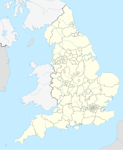
| Location | Ravenglass, Cumbria, England |
|---|---|
| Region | Brittania |
| Coordinates | 54°20′57″N 3°24′15″W / 54.34917°N 3.40417°W |
| Type | Fortification and settlement |
| History | |
| Founded | c.122 |
| Periods | Roman Imperial |
| Site notes | |
| Excavation dates | 1976-8 |
| Public access | yes |
 |
| Part of a series on the |
| Military of ancient Rome |
|---|
|
|
Glannoventa is a Roman fort associated with the Roman naval base at Ravenglass in Cumbria, England.[1] Its name is derived from the Latin place-name Clanoventa as recorded in the 2nd-century Antonine Itinerary, Glannibanta in the 4th-century Notitia Dignitatum, and Cantiventi in the 6th-century Ravenna Cosmography.
An infantry unit of the Roman army based at the fort in 158 AD was the First Cohort Aelia Classica, where ‘Aelius’ was the family name of the Emperor Hadrian, while ‘Classica’ is derived from the Latin classis ‘fleet’, suggesting that the soldiers were recruited from the fleet in Hadrian’s time (117 to 138).[2]
According to the entry in the Notitia Dignitatum, the Cohort I Morinorum, an infantry auxiliary of 500 men was stationed in Ravenglass in the 4th century.[3]
Apart from the extramural bath house, little survives of the fort. A railway line was built through it in the nineteenth century, and one end has been affected by coastal erosion.[4]
A Roman Road led inland via Hardknott Roman Fort and other sites named in the Ravenna Cosmography.[5]
Extra mural structures
[edit]Roman Bath House
[edit]The walls of a bath house, sometimes referred to as Walls Castle, survive to the remarkable height of 4 metres, and include bricked archways. This building was constructed to the north east of the fort. It is under the care of English Heritage.[6]
Vicus
[edit]A project to excavate the vicus ("the civilian area to the east of the fort") began in 2013.[7] It has concentrated on areas identified in a geophysical survey.
References
[edit]- ^ "English Heritage Fieldwork".
- ^ History and Research: Ravenglass Roman Bath House,
- ^ Roman Britain Website,
- ^ "Ravenglass (Itunocelum)" (PDF). Archived from the original (PDF) on 11 December 2009. Retrieved 17 August 2014.
- ^ "OmnesViae: Roman Route Planner- Tabula Peutingeriana and Itinerarium Antonini".
- ^ Muncaster Castle and Ravenglass Bath House article at www.cambridgemilitaryhistory.com
- ^ "Ravenglass Roman fort: Project to unearth civilian settlement". May 2013. Retrieved 19 September 2013.

