Givat Harel


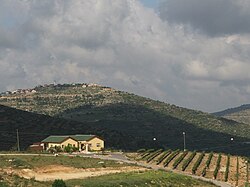
Givat Harel (Hebrew: גבעת הראל) is an Israeli settlement in the West Bank, built as an illegal outpost in 1998 and legalized in 2023 by the Israeli government. The settlement was illegally established in 1998 mostly on Palestinian private lands.[1][2] It falls under the jurisdiction of the Mateh Binyamin Regional Council in the northern West Bank, north of Nahal Shilo. Givat Harel is situated just off Highway 60 (Israel-Palestine), next to the Palestinian village of Sinjil, whose lands were "forcefully seized by Israeli settlers" in order to construct Givat Harel.[3] The international community considers Israeli settlements in the West Bank illegal under international law. In February 2023 the Israeli government approved the legalization of Givat Harel, and 8 other settlements and does not consider them illegal settlements. As part of the legalization Givat Harel and Givat HaRoeh, which also was an outpost before the 2023 legalization were unified into a new settlement called "Giv'ot HaRoeh".
Name
[edit]Givat Harel means Harel's Heights or Hill in Hebrew. The outpost was named after Harel bin Nun, son of Rabbi Elhanan bin Nun , former rabbi of the nearby Shiloh settlement, who was killed along with Shlomo Liebman on August 4th, 1998. After the funeral it was decided to establish an agricultural settlement in Harel's memory.[citation needed]
History
[edit]According to ARIJ, land was "forcefully seized by Israeli settlers" from the Palestinian village of Sinjil in order to construct Givat Harel.[3]
The road to Givat Harel was paved by the Netanyahu government when Ariel Sharon served as minister of national infrastructures.[4]
In July 2012, the IDF fired into the air to disperse settlers from Givat Harel and Palestinians from the neighboring town of Sinjil. A clash erupted when settlers met for prayers at the entrance to the town. The settlers say that Sinjil villagers are farming state land in an attempt to take control of it, while the authorities maintain that the property belongs to Sinjil.[5]
References
[edit]- ^ Settlers take Sharon's advice, occupy hilltops
- ^ Magid, Jacob. "Cabinet okays legalization of 9 West Bank outposts in response to Jerusalem attacks". www.timesofisrael.com. Retrieved 2023-08-18.
- ^ a b Sinjil Town Profile ARIJ, p. 18
- ^ Between Samaria & Gaza, Jerusalem Post
- ^ Chaim Levinson (25 July 2012). "IDF uses live fire to disperse clash between settlers and Palestinians". Haaretz.
External links
[edit]- Givat Harel website
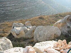
- Givat Harel altar (Hebrew) Archived 2013-09-28 at the Wayback Machine
