
General Tinio
A municipality in the historic province of Nueva Ecija and was named after the youngest general of the Philippine Revolution, General Manuel Tinio y Bundoc
This article has multiple issues. Please help improve it or discuss these issues on the talk page. (Learn how and when to remove these messages)
|
General Tinio | |
|---|---|
 Welcome Arch | |
 Seal | |
 Map of Nueva Ecija with General Tinio highlighted | |
OpenStreetMap  | |
.svg) General Tinio Location within the Philippines | |
| Coordinates: 15°21′N 121°03′E / 15.35°N 121.05°E | |
| Country | Philippines |
| Region | Central Luzon |
| Province | Nueva Ecija |
| District | 4th district |
| Founded | 1921 |
| Named for | Manuel Tinio |
| Barangays | 13 (see Barangays) |
| Government | |
| • Type | Sangguniang Bayan |
| • Mayor | Engr. Isidro T. Pajarillaga |
| • Vice Mayor | Melvin S. Pascual |
| • Representative | Emerson D. Pascual |
| • Municipal Council | Members |
| • Electorate | 39,556 voters (2022) |
| Area | |
| • Total | 245.29 km2 (94.71 sq mi) |
| Elevation | 56 m (184 ft) |
| Highest elevation | 113 m (371 ft) |
| Lowest elevation | 32 m (105 ft) |
| Population (2020 census)[3] | |
| • Total | 55,925 |
| • Density | 230/km2 (590/sq mi) |
| • Households | 13,137 |
| Economy | |
| • Income class | 1st municipal income class |
| • Poverty incidence | 12.61 |
| • Revenue | ₱ 242.3 million (2020) |
| • Assets | ₱ 433.3 million (2020) |
| • Expenditure | ₱ 213.8 million (2020) |
| • Liabilities | ₱ 238 million (2020) |
| Service provider | |
| • Electricity | Nueva Ecija 2 Area 2 Electric Cooperative (NEECO 2 A2) |
| Time zone | UTC+8 (PST) |
| ZIP code | 3104 |
| PSGC | |
| IDD : area code | +63 (0)44 |
| Native languages | Southern Alta Tagalog Ilocano |
| Website | www |
General Tinio is a 1st class municipality[5] in Nueva Ecija, Philippines. Nestled at the foot of the Sierra Madre Mountains and bordered by the Peñaranda River, Rio Chico River, and several other streams, the town’s hilly terrain and dense wild vegetation made it a natural refuge for insurgents resisting colonization during the Spanish, American, and Japanese occupations. These physical barriers allowed freedom fighters to rest and regroup, contributing to the absence of major battles within the town.
Renamed in 1957 to honor revolutionary leader General Manuel Tinio, the town has since developed into a thriving agricultural hub known for its rich cultural festivals - like the Kalamay Festival - and natural attractions like Minalungao National Park. The town’s inspiring history, resilient leaders, and strong sense of community across its barangays continue to shape its legacy and drive its progress.
The town is locally referred to as Papaya but officially called the Municipality of General Tinio (Tagalog: Bayan ng Heneral Tinio, Ilocano: Ili ti Heneral Tinio). It posted an income of 260 M Php in 2020.[6] According to the 2020 census, it has a population of 55,925 people.[3]
The town rests at the foothills of the Sierra Madre Mountains to the East; which is just next to the beach town and the next tuna capital of the Philippines,[7] Dinggalan. Adjoining to the northeast side is the Fort Magsaysay Army Reservation, wherein the national hero Ninoy Aquino and former Senator Jose Diokno were incarcerated during Martial Law in the 1970’s. On the north are the towns of Gabaldon and Laur, named after Laureana Quijano, the wife of General Manuel Tinio. To the West are the towns of Sta. Rosa, Peñaranda and the old city of Gapan where you will find the first minor basilica in Nueva Ecija, the National Shrine of La Virgen Divina Pastora. To the south are the Peñaranda River that leads to the Minalungao National Park and; the town of Doña Remedios Trinidad, named after the former First Lady Imelda Marcos.
History of General Tinio (formerly Papaya)
[edit]The town of General Tinio, previously known as Papaya, has a rich and storied history rooted in the confluence of three barrios of the young town of Peñaranda: Papaya, Rio Chico, and Pias. These three barrios formed the foundation of the town, contributing to its development from a wilderness into a vibrant municipality.
Spanish Era: The Origin of Papaya
[edit]Two accounts mark Papaya to have existed since 1845. One is in the biography of the Katipunero and Comandante Mamerto Padolina who was born in 1845 in Papaya. Another account is the presence of an inscription on the bell at the center of the town saying Barrio de Papaya 1875
However, according to historical accounts and the cultural life of Papaya, Nueva Ecija,[8] , during the Spanish colonial period, the area was a vast wilderness, largely untouched except for intermittent patrols by Spanish soldiers. These soldiers would journey from their headquarters in San Isidro (about 1852), often having trouble finding one another in the uncharted wilderness. In one of their patrols, they decided on a meeting point—a tall papaya tree that stood conspicuously in what is now the old site of the Sto. Cristo Catholic Church. This papaya tree served as a guiding landmark and became the designated meeting spot for the soldiers, eventually giving the area its name: Papaya.

Papaya was initially a sitio of Barrio Mapisong, which later became the town of Peñaranda. Mapisong, as part of the expansive and historically significant town of Gapan (founded in 1595[9]), was within the province of Pampanga until the re-drawing of maps in 1848[10] brought Gapan under the jurisdiction of Nueva Ecija. In May 1851[1], Mapisong was elevated to town status by a Royal Decree, becoming Peñaranda, and Papaya thus became one of its barrios.
Establishment as a Municipality
[edit]The journey of Papaya from being a sitio of Peñaranda to becoming an independent town was a pivotal chapter in its history. On March 10, 1917, by virtue of Act No. 2711,[11] Barrio Papaya was listed among the 27 municipalities of Nueva Ecija. However, the true formation of the independent municipality occurred on October 14, 1920, when Governor-General Francis Burton Harrison issued Executive Order No. 30, officially separating Barrio Papaya, along with Barrio Rio Chico and Barrio Pias, from the town of Peñaranda. This separation became effective on January 1, 1921, marking the beginning of Papaya as an independent municipality. This move was largely facilitated through the collaborative efforts of local leaders Capitan Mamerto Ramos Padolina, who was the Secretary of the Governor of the Province, along with Judge Segundo Bernardo and Francisco Padolina.
Barrio Papaya
[edit]Papaya became the administrative center of the newly formed town, largely due to its strategic location and historical significance as a meeting point for the locals and visitors. It has become known as Poblacion or Bayan. It developed into the hub of governance and commerce for the municipality.
Barrio Rio Chico
[edit]Rio Chico, previously known as Ilog na Munti, played an equally important role in the formation of the town. The name Rio Chico, meaning "small river," was given by Spanish soldiers who were impressed by the small river that ran through the area, providing water and facilitating transportation. Rio Chico was known for its fertile lands along the riverbanks, which allowed the community to thrive. The pioneering families—the Riveras and the Gonzaleses—settled along the river and became the foundation of the community, contributing significantly to the early development of the town.
Barrio Pias
[edit]Pias, the third foundational barrio, was known for its rich natural resources, including bamboo and fish, which were abundant along the banks of the river that ran through the area. According to local legend, the barrio got its name when children mispronounced the word "bias," referring to bamboo tubes that served as hiding places for fish. The name stuck and has been used ever since. Pias also held significance due to its agricultural potential and its position as a gateway to the rugged terrain of the Sierra Madre, which later served as a refuge for guerilla fighters during times of conflict.

Renaming to General Tinio
[edit]After World War II, a movement was initiated to rename the town in honor of General Manuel Tinio (1877 – 1924), the youngest general of President Emilio Aguinaldo; a prominent revolutionary leader from Nueva Ecija who played a significant role in the Philippine Revolution against Spanish colonial rule. Congressman Celestino Juan sponsored a congressional act that was signed into law on June 20, 1957, as Republic Act No. 1665,[12] officially changing the name of Papaya to General Tinio. The renaming of the town was inaugurated on August 19, 1957, recognizing the contributions of General Tinio to the struggle for Philippine independence.
Reorganization during the Martial Law years
[edit]History of the other 6 Barangays from Presidential Decree (P.D.) 86 of 1972
[edit]After the Barrio Papaya, with Barrio Rio Chico and Pias became a town with an elected municipal government in 1921, the Barrio of Papaya had become officially as Barrio Poblacion or "Bayan".
In December 31, 1972, during the martial Law period, P.D 86 Creating Citizen Assemblies[13] revised the Barrio Charter (RA 3590). This was further amended by P.D. 86-A Strengthening and Defining the Role of Barangays (Citizens Assemblies)[14] in January 5, 1973. Under the leadership of Mayor Nicanor Bulacan Aves, these laws were executed and, by 1978, led to the creation of 6 new barangays.
Bayan (Poblacion) then became: Poblacion Central, Poblacion East, Poblacion West, San Pedro, Sampaguita, Pulong Matong
Reclaiming lost territory
[edit]In 1999, under the leadership of Mayor Virgilio Abes Bote, the Local Government of General Tinio filed a territorial dispute to reclaim Barangay Palale from Palayan City. On September 7, 2006, the Supreme Court First Division, in G.R. No. 169089, ruled in favor of General Tinio, officially transferring Barangay Palale back under its jurisdiction. The Barangay was previously one of the northern sitios of Barangay Nazareth before it was transferred to Palayan City in 1982.
Geography
[edit]
Climate
[edit]| Climate data for General Tinio, Nueva Ecija | |||||||||||||
|---|---|---|---|---|---|---|---|---|---|---|---|---|---|
| Month | Jan | Feb | Mar | Apr | May | Jun | Jul | Aug | Sep | Oct | Nov | Dec | Year |
| Mean daily maximum °C (°F) | 29 (84) |
30 (86) |
31 (88) |
34 (93) |
33 (91) |
31 (88) |
30 (86) |
29 (84) |
29 (84) |
30 (86) |
30 (86) |
29 (84) |
30 (87) |
| Mean daily minimum °C (°F) | 20 (68) |
20 (68) |
20 (68) |
22 (72) |
24 (75) |
24 (75) |
24 (75) |
24 (75) |
24 (75) |
23 (73) |
22 (72) |
21 (70) |
22 (72) |
| Average precipitation mm (inches) | 4 (0.2) |
4 (0.2) |
5 (0.2) |
11 (0.4) |
66 (2.6) |
99 (3.9) |
127 (5.0) |
113 (4.4) |
99 (3.9) |
84 (3.3) |
35 (1.4) |
14 (0.6) |
661 (26.1) |
| Average rainy days | 2.2 | 1.9 | 3.2 | 5.3 | 16.1 | 20.8 | 23.5 | 22.8 | 22.2 | 16.5 | 8.9 | 3.5 | 146.9 |
| Source: Meteoblue[15] | |||||||||||||
| Climate data for General Tinio, Nueva Ecija | |||||||||||||
|---|---|---|---|---|---|---|---|---|---|---|---|---|---|
| Month | Jan | Feb | Mar | Apr | May | Jun | Jul | Aug | Sep | Oct | Nov | Dec | Year |
| Mean daily maximum °C (°F) | 29 (84) |
30 (86) |
31 (88) |
34 (93) |
33 (91) |
31 (88) |
30 (86) |
29 (84) |
29 (84) |
30 (86) |
30 (86) |
29 (84) |
30 (87) |
| Mean daily minimum °C (°F) | 20 (68) |
20 (68) |
20 (68) |
22 (72) |
24 (75) |
24 (75) |
24 (75) |
24 (75) |
24 (75) |
23 (73) |
22 (72) |
21 (70) |
22 (72) |
| Average precipitation mm (inches) | 4 (0.2) |
4 (0.2) |
5 (0.2) |
11 (0.4) |
66 (2.6) |
99 (3.9) |
127 (5.0) |
113 (4.4) |
99 (3.9) |
84 (3.3) |
35 (1.4) |
14 (0.6) |
661 (26.1) |
| Average rainy days | 2.2 | 1.9 | 3.2 | 5.3 | 16.1 | 20.8 | 23.5 | 22.8 | 22.2 | 16.5 | 8.9 | 3.5 | 146.9 |
| Source: Meteoblue[15] | |||||||||||||
Demographics
[edit]| Year | Pop. | ±% p.a. |
|---|---|---|
| 1939 | 7,517 | — |
| 1948 | 8,645 | +1.57% |
| 1960 | 14,925 | +4.65% |
| 1970 | 19,353 | +2.63% |
| 1975 | 21,088 | +1.74% |
| 1980 | 23,406 | +2.11% |
| 1990 | 29,491 | +2.34% |
| 1995 | 32,913 | +2.08% |
| 2000 | 35,352 | +1.54% |
| 2007 | 39,356 | +1.49% |
| 2010 | 42,634 | +2.95% |
| 2015 | 47,865 | +2.23% |
| 2020 | 55,925 | +3.11% |
| Source: Philippine Statistics Authority[16][17][18][19] | ||
Economy
[edit]Poverty incidence of General Tinio
5
10
15
20
2006
19.70 2009
15.69 2012
15.38 2015
14.92 2018
5.10 2021
12.61 Source: Philippine Statistics Authority[20][21][22][23][24][25][26][27] |
Farming is the livelihood of majority of the residents. Even though located at the foot of the Sierra Madre Mountain Ridges, the topography is generally plain ideal to agricultural products such as palay and vegetables. A number of poultry broiler contract growers are located in the municipality. Other industries include furniture and fixtures, backyard poultry, cattle and livestock, vegetable production and minor agricultural livelihoods like duck raising. "Ikmo" or betel leaves production is one dying symbol of the town. The practice of chewing betel leaves by the older generation was not adopted by the younger generation even though of its reported natural anti-cancer formula.
The remittances of numerous sons and daughters of Papaya abroad also help keep the economy of the town afloat. Papayanos can be relied to answer calls of assistance for the town's development.
Minalungao National Park is also one of the biggest attraction of the town catering to numerous visitors each day.
Government
[edit]Local government
[edit]The following have led the town from its birth in 1921 to what it had become today.[28]
| American Colonial Period (1898 - 1935) | ||
|---|---|---|
| Municipal President | Municipal Vice President | Term |
| Cristobal Castro Mangulabnan (appointed) | Vice Martin Ramos (appointed) | 1921–1922 |
| Getulio Bote, Sr. | Vice Martin Pajarillaga | 1922–1925 |
| Martin Pajarillaga | Vice Marcos Bote Sr. | 1925–1931 |
| Marcos Bote Sr. | Vice Daniel Padolina | 1931–1934 |
| Melquiades Ronquillo, Sr. | Vice Santiago Bolisay | 1934–1937 |
| Commonwealth Period (1935 - 1946) | ||
| Municipal Mayor | Municipal Vice Mayor | Term |
| Melquades Ronquillo, Sr. | Vice Damaso Bolisay | 1937–1940 |
| Getulio Bote | Vice Pedro Bulacan | 1940–1943 |
| Second Republic (Japanese Occupation 1943-1945) | ||
| Getulio Bote (under Japanese forces) | Vice Pedro Bulacan | 1943–1944 |
| Getulio Bote (transition to Commonwealth government) | Vice Angeles Bote | 1945 |
| Third Republic (1946 - 1972) | ||
| Gerardo Rivera | Vice Angeles Bote | 1946–1947 |
| Gerardo Rivera | Vice Diosdado Bote | 1948–1951 |
| Gerardo Rivera with | Victorino Bote | 1952–1955 |
| Bienvenido Bautista Abes | Vice Victorino Bote | 1956–1959 |
| Gerardo Rivera | Vice Banaag Leodones | 1960–1963 |
| Santos Quitua Bote | Vice Getulio Bote, Jr. | 1964–1967 |
| Mariano Ronquillo | Vice Manuel Domingo | January 1–15, 1968 |
| Manuel Domingo | Vice Perfecto M. Bote | 1968–1971 |
| Nicanor Bautista Aves | Vice Alfonso Pajimna | January 1– September 21, 1972 |
| Fourth Republic (1972 - 1986) | ||
| Nicanor Bautista Aves | Vice Alfonso Pajimna | September 21, 1972 -1980 |
| Nathaniel Bote, Jr. | Vice Venancio Bote | 1981–1986 |
| Fifth Republic (1986 - Present) | ||
| OIC Gerardo Rivera | Vice Antonio Abes | 1986–1988 |
| Placido Maducdoc Calma | Vice Bernardino R. Abes | 1988–1995 |
| Placido Maducdoc Calma | Vice Elsa Bote | 1995–1998 |
| Placido Maducdoc Calma | Vice Bernardino R. Abes | 1998–2004 |
| Isidro Tinio Pajarillaga | Vice Indira P. Dayupay | 2004–2007 |
| Virgilio Abes Bote | Vice Marcelo Bote Abes | 2007–2010 |
| Virgilio Abes Bote | Vice Engr. Ferdinand P. Bote | 2010–2016 |
| Engr. Ferdinand P. Bote | Vice Atty. Melvin Santiago Pascual | 2016– July 3, 2018 |
| Atty. Melvin Santiago Pascual | Vice Anna Rouselle B Busalpa | July 4, 2018-2019 |
| Isidro Tinio Pajarillaga | Vice Atty. Melvin Santiago Pascual | 2019–present |
Barangays
[edit]General Tinio is politically subdivided into 13 barangays. Each barangay consist of puroks and some have sitios.
- Padolina (Barangay 1)
- Concepcion (Barangay 2)
- Rio Chico (Barangay 3)
- Pias (Barangay 4)
- Nazareth (Barangay 5)
- Bago (Barangay 6)
- Poblacion West (Barangay 7)
- Poblacion Central (Barangay 8)
- San Pedro (Barangay 9)
- Sampaguita (Barangay 10)
- Poblacion East (Barangay 11)
- Pulong Matong (Barangay 12)
- Palale (Barangay 13)
Brief History of Rio Chico
[edit]This tow is formerly known as "Ilog na Munti," got its name from the small river that runs through the area. During the early days of Spanish rule, a few groups of Negritos inhabited this place, and later clearings were opened by neighboring townspeople. The name "Ilog na Munti" was translated into Spanish as "Rio Chico," which has been its official name ever since. The pioneering families of the area were the Riveras and Gonzales, who contributed significantly to the development of the community. The first Cabeza of the barrio was Anastacio Rivera, who was also regarded as its founder.
The sitio of Baste (now known as Barangay Bago), located northeast of Rio Chico near the Sierra Madre Mountains, was an important agricultural site and served as an evacuation center during World War II. Baste was also a hiding place for the Hukbalahaps and guerrilla fighters during the Japanese occupation. Other sitios under Rio Chico's jurisdiction include Pias, Nazareth, Makabaklay, Batug, Calumpit, Binumbunan, and Santuyo, each with its unique historical and cultural significance.
Brief History of Pias
[edit]Pias was a previous sitio of Rio Chico.
Barangay Nazareth
[edit]Nazareth is the gateway to the Upper Tabuating Irrigation Project, is notable for its diverse land use, which includes eco-tourism areas and residential subdivisions. Spanning 16,300 hectares, this barangay is integral for both agricultural and residential development, housing several large-scale projects.
Originally named "Querollo" after the Querollo Creek, Barangay Nazareth emerged from its status as a sitio of Rio Chico to become an independent barrio in the early part of 1935. The original families were the Ramos, Reyes, Madrid, Mangulabnan, Quinto, and Abrigos families, who played crucial roles in its formation. During World War II, Nazareth served as an evacuation center for both civilians and guerrilla fighters. It was a strategic location, with Juan Ramos being one of the key figures who supported guerrilla activities. The Methodist Chapel built in 1934 remains as one of the historical landmarks of the barrio.
Barangay Nazareth is also the starting point for rivers like Bugnan and Coronel, which provide water resources crucial for agriculture in neighboring areas. The barangay is home to Nazareth Elementary School and other facilities, making it an important community for education and agriculture in General Tinio.
Barangay Nazareth used to include the sitio of Palale which was transferred to Palayan City in 1982.
Barangay Bago
[edit]Bago is one of the oldest barangays, covering 1,185.55 hectares. It serves as a key livestock development area and is home to the Bago-Nazareth Memorial Park. The barangay's irrigation facilities support 45 hectares of agricultural land, while its four schools collectively serve over 1,500 students. Bago’s combination of agriculture, livestock, and community facilities underlines its diverse contributions to General Tinio.
Barangay Bago, one of the oldest barangays in the municipality of General Tinio, this used to be the sitio of Baste, which lies northeast of Rio Chico near the foot of the Sierra Madre Mountains. Sitio Baste was named after Baste Creek and was established in 1938. The first and last head of the barrio was Teniente del Barrio Celino Bago alias "Katyao". Later on, the Barangay was named after him.
The early settlers of Baste were Cabezang Cornelio Jardiel, Cabezang Alipio Ramos, Cabezang Maximo Ranoz—all from Peñaranda—and Cabezang Crisodono Mangulabnan. Baste flourished as an agricultural hub and was also an important evacuation center during World War II.
During the Japanese occupation, Baste became a key hiding place for the Hukbalahaps and Filipino guerrillas, making it an important part of the resistance movement. At its peak, the sitio had around forty scattered houses, and a schoolhouse was built in the central part, with Mrs. Asuncion B. Pajinna as its first teacher in 1941. However, the outbreak of the war led to the closure of the school, and during the conflict between the Hukbalahaps and the USAFFE guerrillas, the sitio was ultimately evacuated, leaving it extinct. Many former residents moved to Barangay Rio Chico or the poblacion area of Papaya (now General Tinio).
Barangay Padolina
[edit]Established in 1965, Barangay Padolina covers a land area of 573.20 hectares. The lowest point in the municipality, about 40 meters above sea level, can be found here, with the Peñaranda River flowing nearby. This fertile land is one of the major agricultural hubs of General Tinio, producing various farm products that contribute significantly to the town’s food supply. The town was named after Mamerto Ramos Padolina (1845-1923), a katipunero and a komandante during the Philippine revolution; who was born at Sitio Papaya, Barrio Mapisong (now Peñaranda), town of Gapan, in the province of Pampanga. Padolina was also one of the three leaders who pushed the agenda to turn Papaya into a town.
In terms of education, Padolina Elementary School serves the community with 409 pupils and a student-to-teacher ratio of 1:27. Recreational facilities such as Hacienda Nicolas, Villa Ofelia Resort, and Belarmino Resort cater to various community gatherings, and the barangay also houses 40 business establishments that meet residents' needs.
Padolina is notable for its irrigation system that supports 60 hectares of agricultural land, vital for local farming. Water supply is well-established, with 673 connections servicing 3,365 households, while electricity is provided to 1,521 households by NEECO II-Area 2. This barangay plays a key role in maintaining the food security of General Tinio.
Barangay Concepcion
[edit]This is among the earliest established barangays in General Tinio, known for its strategic location along the national and provincial roads, making it one of the municipality's commercial hubs. With a land area of 219.20 hectares, it is just 1.2 kilometers away from the municipal hall. Concepcion is home to Baliwag Transit Inc., a major bus company connecting residents to Metro Manila.
Concepcion's educational facilities include East Elementary School, which enrolls 667 pupils, supported by a teaching staff of 26. There are also 64 businesses and a slaughterhouse, enhancing the barangay’s economic activities. Irrigable land of 25 hectares further underscores its agricultural value. Water supply and electricity are well-provided, with a comprehensive infrastructure network that ensures reliable service for the community.
Barangay Palale
[edit]Barangay Palale covers a total land area of 3,816 hectares and is situated 2.2 kilometers away from the municipal hall. The main source of water is the Talictic Creek, which drains towards Palayan City and the Municipality of Laur. Despite being a geographically isolated and disadvantaged area (GIDA), Palale continues to be an important part of General Tinio’s landscape. The barangay also plays a key role in historical origins and socio-cultural practices of the town as the population of the barangay are part of the local indigenous community.
The decision to return Barangay Palale to General Tinio was a significant event that restored the community's historical connection to the municipality, allowing for better integration and local governance.
Barangay Poblacion Central
[edit]Barangay Poblacion East
[edit]Barangay Poblacion West
[edit]Barangay San Pedro
[edit]Barangay Sampaguita
[edit]Barangay Pulong Matong
[edit]Culture
[edit]Roman Catholic is the most prevalent religion, with Iglesia ni Cristo, IEMELIF, Baptist, Methodist, and others attracting its own followers. The town's patron saint, the Santo Cristo or the Holy Cross is being feted every May.
The town is best known for having the most number of brass bands in the Philippines with 15 organized bands. These bands are sought after to enhance entertainment ambience in fiestas and other traditional rites such as wakes. The Family band is the most popular one and have produced champions in majorette exhibition, solo flute competition, solo clarinet competition, solo trumpet competition, French horn competition, etc., in national brass band competitions.
The town also has other places of interest notably Minalungao National Park which is a favorite swimming destinations in summer, specially during Black Saturday when it is usually filled with local bathers and visitors. Minalungao, literally meaning "mine of gold in a cave", has several caves which can explored. The river also has a portion where a stone ledge located about 15 meters high from the river can be used as spring board.
Papaya Festival is also celebrated coincide with its Foundation Anniversary, Parade of different school students around the town wearing colourful costume inspired by the fruits Papaya which this town got its name until it was change to General Tinio
Gallery
[edit]-
 Town hall
 -
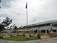 Sports center
 -
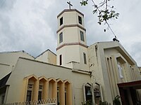 Old Santo Cristo Parish Church
 -
 New Holy Cross Parish Church
 -
 Public market
 -
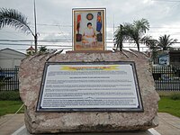 Cory Aquino memorial
 -

-
 The Upper Tabuating Dam at Brgy. Nazareth


See also
[edit]References
[edit]- ^ Municipality of General Tinio | (DILG)
- ^ "2015 Census of Population, Report No. 3 – Population, Land Area, and Population Density" (PDF). Philippine Statistics Authority. Quezon City, Philippines. August 2016. ISSN 0117-1453. Archived (PDF) from the original on May 25, 2021. Retrieved July 16, 2021.
- ^ a b Census of Population (2020). "Region III (Central Luzon)". Total Population by Province, City, Municipality and Barangay. Philippine Statistics Authority. Retrieved 8 July 2021.
- ^ "PSA Releases the 2021 City and Municipal Level Poverty Estimates". Philippine Statistics Authority. 2 April 2024. Retrieved 28 April 2024.
- ^ "Atin ang Pilipinas - Local Races - General Tinio". www.rappler.com. May 13, 2022. Retrieved September 27, 2024.
- ^ Republic of the Philippines, Commission on Audit. "2021 COA Executive Report for General Tinio" (PDF). Commission on Audit Executive Summary. Retrieved September 21, 2024.
- ^ Ochave, Revin Mikhael D. (August 3, 2020). "Dingalan town to be developed as next 'tuna capital'". Business World. Retrieved September 21, 2024.
- ^ Bal, Graciano P.; Pajimna, Conrado P.; Mangulabnan, Sulpicio B.; Abesamis, Guillermo B; Lustre, Maximo; Pajarillaga, Celso B; Abesamis, Filipinas P. (1952). "Papaya, Nueva Ecija Historical Data Papers from the Collections of the National Memory Project". National Historical Commission of the Philippines. Retrieved 2024-09-02.
- ^ "History of Gapan City". City of Gapan Website. Retrieved September 27, 2024.
- ^ "Nueva Ecija Gobierno Civil. Cartographical Collection. National Library of the Philippines. Map of Nueva Ecija". Provincias Y Distritos de la Isla de Luzon. Cartographical Collection. National Library of the Philippines. Retrieved September 27, 2024.
- ^ Harrison, Francis Burton (1917) [March 10, 1917]. "Act No. 2711 - The Official Gazette of the Republic of the Philippines". Official Gazette of the Republic of the Philippines. Retrieved September 2, 2024.
- ^ "An Act Changing the Name of the Municipality of Papaya in the Province of Nueva Ecija to General Tinio". LawPH.com. Retrieved 2011-04-12.
- ^ Marcos, Ferdinand E. (December 31, 1972). "Presidential Decree No. 86, Creating Citizen Assemblies". Chanrobles Law Library. Retrieved September 28, 2024.
- ^ Marcos, Ferdinand E. (January 5, 1973). "Presidential Decree No. 86-A, Strengthening and Defining the Role of Barangays (Citizens Assemblies)". Supreme Court of the Philippines eibrary. Retrieved September 28, 2024.
- ^ a b c "General Tinio: Average Temperatures and Rainfall". Meteoblue. Retrieved 4 May 2020.
- ^ Census of Population (2015). "Region III (Central Luzon)". Total Population by Province, City, Municipality and Barangay. Philippine Statistics Authority. Retrieved 20 June 2016.
- ^ Census of Population and Housing (2010). "Region III (Central Luzon)" (PDF). Total Population by Province, City, Municipality and Barangay. National Statistics Office. Retrieved 29 June 2016.
- ^ Censuses of Population (1903–2007). "Region III (Central Luzon)". Table 1. Population Enumerated in Various Censuses by Province/Highly Urbanized City: 1903 to 2007. National Statistics Office.
- ^ "Province of Nueva Ecija". Municipality Population Data. Local Water Utilities Administration Research Division. Retrieved 17 December 2016.
- ^ "Poverty incidence (PI):". Philippine Statistics Authority. Retrieved December 28, 2020.
- ^ "Estimation of Local Poverty in the Philippines" (PDF). Philippine Statistics Authority. 29 November 2005.
- ^ "2003 City and Municipal Level Poverty Estimates" (PDF). Philippine Statistics Authority. 23 March 2009.
- ^ "City and Municipal Level Poverty Estimates; 2006 and 2009" (PDF). Philippine Statistics Authority. 3 August 2012.
- ^ "2012 Municipal and City Level Poverty Estimates" (PDF). Philippine Statistics Authority. 31 May 2016.
- ^ "Municipal and City Level Small Area Poverty Estimates; 2009, 2012 and 2015". Philippine Statistics Authority. 10 July 2019.
- ^ "PSA Releases the 2018 Municipal and City Level Poverty Estimates". Philippine Statistics Authority. 15 December 2021. Retrieved 22 January 2022.
- ^ "PSA Releases the 2021 City and Municipal Level Poverty Estimates". Philippine Statistics Authority. 2 April 2024. Retrieved 28 April 2024.
- ^ "Elected Officials of General Tinio 2013-2016". Generaltinio.gov.ph. 2010-07-12. Retrieved 2016-11-23.
External links
[edit]Places adjacent to General Tinio | ||||||||||||||||
|---|---|---|---|---|---|---|---|---|---|---|---|---|---|---|---|---|
| ||||||||||||||||
| Municipalities | |
|---|---|
| Component cities | |