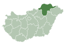
Fony, Hungary
Appearance
Fony | |
|---|---|
Village | |
| Coordinates: 48°23′29.19″N 21°17′0.2″E / 48.3914417°N 21.283389°E | |
| Country | |
| Regions | Northern Hungary |
| County | Borsod-Abaúj-Zemplén County |
| Area | |
| • Total | 40.55 km2 (15.66 sq mi) |
| Population (2008) | |
| • Total | 374 |
| Time zone | UTC+1 (CET) |
| • Summer (DST) | UTC+2 (CEST) |
Fony is a village in Borsod-Abaúj-Zemplén County in northeastern Hungary. As of 2008[update], the village had a population of 374.[1]
Until the holocaust of the Hungarian Jews, a Jewish community lived in Fony and there was a synagogue there.[2][3]
Geography[edit]
Fony is situated on the west side of the Zemplén Mountains. It has road connections with Vilmány, Korlát, Regéc and Mogyoróska.
References[edit]
- ^ KSH (in Hungarian)
- ^ "galériák - Zsinagógák a történelmi Magyarországon". magyarzsido.hu. Retrieved 2024-06-25.
- ^ "A zsidó népesseg száma településenként 1840–1941 (1993) | Könyvtár | Hungaricana". library.hungaricana.hu. Retrieved 2024-06-25.


