Folarskardnuten
Appearance
| Folarskardnuten | |
|---|---|
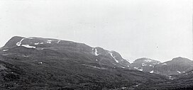
 Folarskardnuten seen from Rakstein valley | |
| Highest point | |
| Elevation | 1,933 m (6,342 ft) |
| Prominence | 917 m (3,009 ft)[1] |
| Isolation | 86.7 to 86.9 km (53.9 to 54.0 mi) |
| Listing | 6 at List of highest points of Norwegian counties |
| Coordinates | 60°36′35.66″N 7°43′21.70″E / 60.6099056°N 7.7226944°E |
| Geography | |
 | |
| Location | Hol, Buskerud, Norway |
| Parent range | Hallingskarvet |
| Topo map | 1516 III Hallingskarvet |
Folarskardnuten is the highest point on Hallingskarvet, and is also the highest point in the county Buskerud of Norway.
The mountain lies within Hallingskarvet National Park, Hol Municipality.
See also
[edit]References
[edit]
